Aalst, Zaltbommel
| Aalst | ||
|---|---|---|
| Village | ||
| ||
 | ||
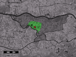 The village centre (red) and the statistical district (light green) of Aalst in the municipality of Zaltbommel. | ||
| Coordinates: 51°47′N 5°7′E / 51.783°N 5.117°ECoordinates: 51°47′N 5°7′E / 51.783°N 5.117°E | ||
| Country | Netherlands | |
| Province | Gelderland | |
| Municipality | Zaltbommel | |
| Population (1 January 2010) | ||
| • Total | 1,986 | |
| Time zone | CET (UTC+1) | |
| • Summer (DST) | CEST (UTC+2) | |
| Postal code | 5308 | |

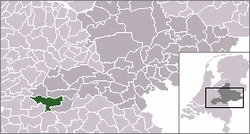
Aalst [aːɫst] is a village in the Dutch province of Gelderland. It is a part of the municipality of Zaltbommel, and lies about 12 km southeast of Gorinchem.
In 2005, the village of Aalst proper had 1950 inhabitants. The built-up area of the village was 0.32 km², and contained 525 residences.[1] The statistical area "Aalst", which also includes the surrounding countryside, has a population of around 2020.[2]
For a short while, Aalst was a separate municipality. In 1818, it became a part of the municipality of Poederoijen.[3] According to the historian Van der Aa, there used to be an old castle here, but only a few remnants were left in the middle of the 19th century.[4]
References
- ↑ Statistics Netherlands (CBS), Bevolkingskernen in Nederland 2001. (Statistics are for the continuous built-up area).
- ↑ Statistics Netherlands, 2007. Figures are for the year 2006. Statistics are available in Google Earth format.
- ↑ Ad van der Meer and Onno Boonstra, Repertorium van Nederlandse gemeenten, KNAW, 2006.
- ↑ Abraham Jacob van der Aa, "Aardrijkskundig woordenboek der Nederlanden", vol. 1 (A), 1839, p. 15.
This article is issued from Wikipedia - version of the 2/15/2016. The text is available under the Creative Commons Attribution/Share Alike but additional terms may apply for the media files.