Albany Municipal Airport (Oregon)
|
|
Albany Municipal Airport Historic District |
|
|
|
|
 |
| Location |
Albany, Oregon |
|---|
| Area |
588 acres (238 ha)[2] |
|---|
| Built |
1929[3] |
|---|
| Architect |
Cleo H. Jenkins[4] |
|---|
| NRHP Reference # |
98000630[3] |
|---|
| Added to NRHP |
June 3, 1998[3] |
|---|
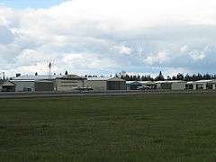
Albany Municipal Airport (FAA LID: S12) is a general aviation airport located 3 nautical miles (6 km) east of the city of Albany in Linn County, Oregon, United States. It is publicly owned and operated by the City of Albany.[5] It is the oldest known operating airfield in Oregon, opening in 1920.[6] There are 58 aircraft based at the municipal airport; 49 Single engine airplanes, 7 multi engine, and 2 jet airplanes. On average there are 62 aircraft operations per day.[5]
History
- First opened to the public in 1920 by private owners
- In 1929 the City of Albany buys the property and names it the Albany Municipal Airport
- A 1931 airshow inspired the Northwest Art and Air Festival
- A jet first landed in Albany in 1964
- In 1998, Albany Municipal Airport became the first airport in Oregon to be listed on the National Register of Historic Places (as the Albany Municipal Airport Historic District)
Cargo Service
References
- ↑ FAA Airport Master Record for S12 (Form 5010 PDF)
- ↑ "Nationalregisterofhistoricplaces.com". Retrieved 2008-03-29.
- 1 2 3 "Oregon National Register List" (PDF). Oregon Parks and Recreation Department. June 6, 2011. p. 24. Retrieved September 28, 2013.
- ↑ National Park Service. "National Register Information System". Archived from the original on June 11, 2007. Retrieved 2008-03-29.
- 1 2 http://www.airnav.com/airport/S12
- ↑ http://www.dhonline.com/articles/2009/03/04/news/people/5peo01_flight.txt
External links
|
|---|
|
| Commercial | |
|---|
|
| Relief | |
|---|
|
| General | |
|---|
|
| Military | |
|---|
|
| State-owned | |
|---|
|
| Other | |
|---|

