Altdorf Forest
| Altdorf Forest | |
|---|---|
 | |
| Highest point | |
| Peak | Galgenberg |
| Elevation | 776.6 m (2,548 ft) |
| Geography | |
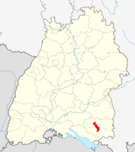 between Aulendorf and Vogt; | |
| Range coordinates | 47°46′N 9°44′E / 47.77°N 9.73°ECoordinates: 47°46′N 9°44′E / 47.77°N 9.73°E |
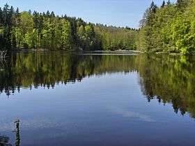
The Altdorf Forest (German: Altdorfer Wald) is a forested, low mountain ridge between Aulendorf and Vogt in the county of Ravensburg in the German state of Baden-Württemberg. It is up to 776.6 m above sea level (NHN)[1] high.
The forest has an area of about 82 km²[2] and is thus the largest contiguous forest in Upper Swabia. It is divided into state, municipal and private forests, of which the aristocratic House of Waldburg-Wolfegg owns the largest area.
References
- ↑ Map services of the Federal Agency for Nature Conservation
- ↑ Landscape fact file by the BfN – Altdorfer Wald
Literature
- Anton Huber: Beiträge zur Geschichte des Altdorfer Waldes. Staatliches Forstamt, Ravensburg, 1998
- Jochen Jauch: Geschichte und Geschichten aus dem Altdorfer Wald. Von der Försterei Gambach zum Forstrevier Bergatreute. Eppe, Bergatreute, 2012, ISBN 978-3-89089-153-8
- Volker Kracht (ed.): Die Naturschutzgebiete im Regierungsbezirk Tübingen. 2nd edition. Thorbecke, Ostfildern, 2006, ISBN 978-3-7995-5175-5 (includes coverage of the few nature reserves in the Altdorf Forest)
- J. D. G. von Memminger: Der Altdorfer Wald, in: Beschreibung des Oberamts Ravensburg. Cotta, Stuttgart and Tübingen, 1836 (e-text and digital version at Wikisource)
- Der Altdorfer Wald, in: Allgemeine Forst und Jagdzeitung, 9th annual issue, 1840, pp. 424ff. (digitalised)
External links
 |
Wikimedia Commons has media related to Altdorf Forest. |
- 3202 Altdorfer Wald, landscape fact file by the BfN
This article is issued from Wikipedia - version of the 11/4/2016. The text is available under the Creative Commons Attribution/Share Alike but additional terms may apply for the media files.