Amendolea
Coordinates: 37°56′N 15°53′E / 37.933°N 15.883°E
| Amendolea | |
|---|---|
 | |
| Country | Italy |
| Basin | |
| Main source |
Aspromonte 1,805 m (5,922 ft) |
| River mouth | Ionian Sea |
| Basin size | 150.40 km2 (58.07 sq mi) |
| Physical characteristics | |
| Length | 68.75 km (42.72 mi) |
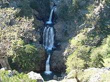
The Amendolea (possibly Latin: Kaikinos)[1] is a river in the province of Reggio Calabria in the Calabria region of southern Italy.[2] Its source is near Montalto in Aspromonte National Park. The river flows south past Roghudi and Condofuri and empties into the Ionian sea west of Bova Marina.
References
- ↑ Richard J.A. Talbert, ed. (2000). Barrington Atlas of the Greek and Roman World: Map-By-Map Directory. I. Princeton, NJ and Oxford, UK: Princeton University Press. p. 698. ISBN 0691049459.
- ↑ The Times Comprehensive Atlas of the World (13 ed.). London: Times Books. 2011. p. 78 J8. ISBN 9780007419135.
This article is issued from Wikipedia - version of the 4/5/2016. The text is available under the Creative Commons Attribution/Share Alike but additional terms may apply for the media files.