Arkansas Highway 363
| ||||
|---|---|---|---|---|
| Route information | ||||
| Maintained by AHTD | ||||
| Section 1 | ||||
| Length: | 1.08 mi[1] (1.74 km) | |||
| South end: |
.svg.png)  US 64 / AR 247 – Pottsville US 64 / AR 247 – Pottsville | |||
| North end: | Phillips Road | |||
| Section 2 | ||||
| Length: | 2.10 mi[1] (3.38 km) | |||
| East end: | Local road outside Atkins | |||
| West end: |
 AR 105 / AR 247 AR 105 / AR 247 | |||
| Location | ||||
| Counties: | Pope | |||
| Highway system | ||||
| ||||


Arkansas Highway 363 is the name of two state highways in Pope County.[2]
Section 1
Arkansas Highway 363 is a 1.0-mile-long (1.6 km) state highway in Pope County near Pottsville. The route runs north from US 64/AR 247 across Interstate 40 to terminate at Phillips Road. The entire route is in Pottsville, Pope County.
| mi[1] | km | Destinations | Notes | ||
|---|---|---|---|---|---|
| 0.00 | 0.00 | US 64 / AR 247 | |||
| 0.08 | 0.13 |  I-40 I-40 | |||
| 1.08 | 1.74 | End state maintenance | |||
| 1.000 mi = 1.609 km; 1.000 km = 0.621 mi | |||||
Section 2
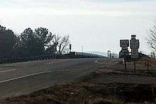
Highway 363 terminates at Highway 105 near I-40 in Atkins
Arkansas Highway 363 is a brief 2.1-mile-long (3.4 km) state highway in Pope County. It runs east into Atkins to terminate at AR 105/AR 247 at the interchange with Interstate 40. The entire route is in Pope County.
| Location | mi[1] | km | Destinations | Notes | |
|---|---|---|---|---|---|
| | 0.00 | 0.00 | End state maintenance | ||
| Atkins | 2.10 | 3.38 | AR 105 / AR 247 | ||
| 1.000 mi = 1.609 km; 1.000 km = 0.621 mi | |||||
References
- 1 2 3 4 Route and Section Map (PDF) (Map). Pope County. Arkansas State Highway and Transportation Department. Retrieved August 25, 2011.
- ↑ Arkansas State Highway and Transportation Department. AHTD Pope County map Retrieved on April 3, 2010.
This article is issued from Wikipedia - version of the 6/19/2016. The text is available under the Creative Commons Attribution/Share Alike but additional terms may apply for the media files.