Atchuelinguk River
| Atchuelinguk River | |
| Country | United States |
|---|---|
| State | Alaska |
| Census Area | Kusilvak |
| Source | Nulato Hills |
| - location | Yukon Delta National Wildlife Refuge |
| - elevation | 2,006 ft (611 m) [1] |
| - coordinates | 63°02′38″N 161°26′38″W / 63.04389°N 161.44389°W [2] |
| Mouth | Yukon River |
| - location | 25 miles (40 km) west of Marshall |
| - elevation | 0 ft (0 m) [2] |
| - coordinates | 61°57′30″N 162°49′38″W / 61.95833°N 162.82722°WCoordinates: 61°57′30″N 162°49′38″W / 61.95833°N 162.82722°W [2] |
| Length | 165 mi (266 km) [2] |
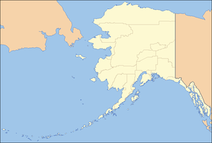  Location of the mouth of the Atchuelinguk River in Alaska
| |
The Atchuelinguk River (Yup'ik Ecuilnguq, literally "clear water"[3]) Atchuelinguk is a 165-mile (266 km) tributary of the Yukon River in the U.S. state of Alaska.[2] It flows southwest from the Nulato Hills through the Yukon Delta National Wildlife Refuge to meet the larger river near Pilot Station.[4]
See also
References
- ↑ Derived by entering source coordinates in Google Earth.
- 1 2 3 4 5 "Atchuelinguk River". Geographic Names Information System. United States Geological Survey. March 23, 2001. Retrieved September 29, 2013.
- ↑ Jacobson, Steven A. (2012). Yup'ik Eskimo Dictionary, 2nd edition. Alaska Native Language Center.
- ↑ Alaska Atlas & Gazetteer (7th ed.). Yarmouth, Maine: DeLorme. 2010. pp. 130–31. ISBN 978-0-89933-289-5.
This article is issued from Wikipedia - version of the 9/10/2016. The text is available under the Creative Commons Attribution/Share Alike but additional terms may apply for the media files.