Attawapiskat 91A
| Attawapiskat 91A ᐋᐦᑕᐙᐱᐢᑲᑐᐎ | |
|---|---|
| Indian reserve | |
| Attawapiskat Indian Reserve No. 91A | |
|
Attawapiskat Settlement between Attawapiskat River and James Bay | |
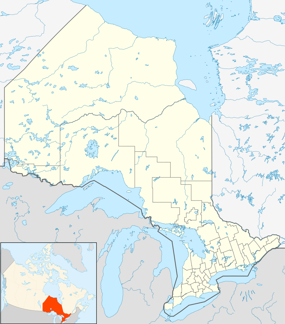  Attawapiskat 91A | |
| Coordinates: 52°55′N 82°26′W / 52.917°N 82.433°W | |
| Country |
 Canada Canada |
| Province |
 Ontario Ontario |
| Division | Kenora District |
| First Nation | Attawapiskat |
| Established | 1950 |
| Government | |
| • Chief | Theresa Spence |
| Area | |
| • Land | 1.19 km2 (0.46 sq mi) |
| Population (2011) | |
| • Total |
Incompletely enumerated[1] 1,929[2] |
| Time zone | EST (UTC-5) |
| • Summer (DST) | EDT (UTC-4) |
| Postal code span | P0L 1A0 |
| Area code(s) | 705 |
| Website | www.attawapiskat.org |

Attawapiskat 91A is the main reserve of the Attawapiskat First Nation, near the mouth of the Attawapiskat River.
References
- ↑ "Attawapiskat 91A census profile". 2011 Census of Population. Statistics Canada. Retrieved 2015-05-20.
- ↑ Linda Goyette (December 10, 2010). "Attawapiskat: The State of First Nations Education in Canada". Canadian Geographic. Retrieved 2011-12-03.
External links
 |
Unorganized Kenora District | | ||
| Unorganized Kenora District |  |
Attawapiskat River | ||
| ||||
 | ||||
| Unorganized Kenora District |


This article is issued from Wikipedia - version of the 10/21/2016. The text is available under the Creative Commons Attribution/Share Alike but additional terms may apply for the media files.