Aurillac – Tronquières Airport
| Aurillac – Tronquières Airport Aéroport d'Aurillac – Tronquières | |||||||||||
|---|---|---|---|---|---|---|---|---|---|---|---|
| IATA: AUR – ICAO: LFLW | |||||||||||
| Summary | |||||||||||
| Airport type | Public | ||||||||||
| Operator | CABA | ||||||||||
| Serves | Aurillac, Cantal, Auvergne, France | ||||||||||
| Elevation AMSL | 639 m / 2,096 ft | ||||||||||
| Coordinates | 44°53′51″N 02°25′00″E / 44.89750°N 2.41667°ECoordinates: 44°53′51″N 02°25′00″E / 44.89750°N 2.41667°E | ||||||||||
| Website | Aéroport d'Aurillac – Tronquières | ||||||||||
| Maps | |||||||||||
 Auvergne region in France | |||||||||||
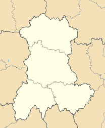  LFLW Location of the airport in Auvergne | |||||||||||
| Runways | |||||||||||
| |||||||||||
Aurillac – Tronquières Airport (French: Aéroport d'Aurillac – Tronquières) (IATA: AUR, ICAO: LFLW) is an airport located 3 kilometres (1.9 mi) southwest of Aurillac,[1] a commune of the Cantal département in the Auvergne région of France.
Airlines and destinations
| Airlines | Destinations |
|---|---|
| HOP! | Paris-Orly Seasonal: Ajaccio, Castres |
References
- 1 2 LFLW – Aurillac. AIP from French Service d'information aéronautique, effective 10 November 2016.
- ↑ Airport information for LFLW at World Aero Data. Data current as of October 2006.
- ↑ Airport information for LFLW at Great Circle Mapper.
- ↑ Airport information for Aurillac Airport at Search (for) Travel website.
External links
- Aéroport d'Aurillac – Tronquières at CABA (French)
- Aéroport d'Aurillac at Union des Aéroports Français (French)
- Current weather for LFLW at NOAA/NWS
- Accident history for AUR at Aviation Safety Network
This article is issued from Wikipedia - version of the 12/4/2016. The text is available under the Creative Commons Attribution/Share Alike but additional terms may apply for the media files.