Balabyne
| Balabyne Балабине | |
|---|---|
| Urban-type settlement | |
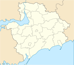  Balabyne Location of Balabyne in Zaporizhia Oblast | |
| Coordinates: UA 47°44′39″N 35°13′13″E / 47.74417°N 35.22028°ECoordinates: UA 47°44′39″N 35°13′13″E / 47.74417°N 35.22028°E | |
| Country |
 Ukraine Ukraine |
| Province | Zaporizhia Oblast |
| District | Zaporizhia Raion |
| Founded | 1777 |
| Settlement status | 1938 |
| Area | |
| • Total | 2.613 km2 (1.009 sq mi) |
| Elevation[1] | 35 m (115 ft) |
| Population (2013) | |
| • Total |
 6,166 6,166 |
| Time zone | EET (UTC+2) |
| • Summer (DST) | EEST (UTC+3) |
| Postal code | 70435–436 |
| Area code | +380 61 |
| Climate | Dfa |
| Website | http://rada.gov.ua/ |
Balabyne (Ukrainian: Балабине; Russian: Балабино) is an urban-type settlement in the Zaporizhia Raion (district) of Zaporizhia Oblast in southern Ukraine. Balabyne is the administrative center of the Balabyne Council, a local government area.[2] Population: 6,166 (2013 est.)[3]. In 2001, population was 5,668 according to the census.[2]
The settlement was first founded in 1777 as the village of Petrivska (Ukrainian: Петрівська). In 1938, it was renamed to Balabyne and given the status of an urban-type settlement.[2] It is located on the left bank of the Kakhovka Reservoir, just south of Zaporizhia's Komunarskyi District.
References
- ↑ "Balabyne (Zaporizhia Oblast, Zaporizhia Raion)". weather.in.ua. Retrieved 14 January 2015.
- 1 2 3 "Balabyne, Zaporizhia Oblast, Zaporizhia Raion". Regions of Ukraine and their Structure (in Ukrainian). Verkhovna Rada of Ukraine. Archived from the original on 4 March 2016. Retrieved 14 January 2015.
- ↑ "Чисельність наявного населення України (Actual population of Ukraine)" (in Ukrainian). State Statistics Service of Ukraine. Retrieved 21 January 2015.
| Urban-type settlements |  | |
|---|---|---|
| Villages |
| |
| Rural settlements | ||

This article is issued from Wikipedia - version of the 10/24/2016. The text is available under the Creative Commons Attribution/Share Alike but additional terms may apply for the media files.