Banera
| Banera | |
|---|---|
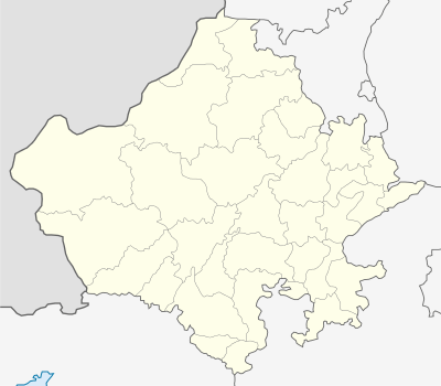  Banera Location in Rajasthan state of India. Inset shows the Rajasthan within India. | |
| Coordinates: 25°30′24″N 74°40′30″E / 25.506677°N 74.675016°ECoordinates: 25°30′24″N 74°40′30″E / 25.506677°N 74.675016°E | |
| Country |
 India India |
| Languages | |
| Time zone | IST (UTC+5:30) |
Banera is a tehsil located in the Bhilwara district in the state of Rajasthan in India. It is one of the 12 tehsils of the Bhilwara district.[1]
As recorded in Census of India 2011, Bhilwara district came into existence in 1949, which constituted with Banera & Badnor chief ship of Mewar State and merger of Mandalgarh & Shahpura Thikana.
It was built in 1750.[2] There is also a Krishna temple, Charbujha temple, Jhalra mahadev temple, Kavarbavaji temple, Hanuman temple, Veer Tejaji temple and many more. The landline code is 01487.
The town has a Government Upper Primary School and a Community Health Center.[3]
Banera was also a constituency in the Legislative Assembly of Rajasthan until 2008.[4] Since 2008, it was merged with the Shahpura, Bhilwara constituency by the Delimitation Commission of India.[5]
References
- ↑ "Administration - Bhilwara". District Administration Bhilwara. Retrieved 23 May 2014.
- ↑ Rajasthan [district Gazetteers].: Bhilwara. Government Central Press. 1975. p. 44.
- ↑ "79 fall ill after eating mid-day meal in Rajasthan". Daily News and Analysis. 31 July 2013. Retrieved 23 May 2014.
- ↑ "157 - Banera Assembly Constituency - (Partywise Comparison Since 1977)". Election Commission of India. Retrieved 23 May 2014.
- ↑ "Delimitation of Parliamentary and Assembly Constituencies Order, 2008" (pdf). Election Commission of India. p. 363. Retrieved 23 May 2014.