Bathurst Channel
| Bathurst Channel | |
|---|---|
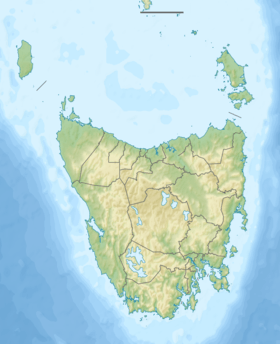  Bathurst Channel Location on the south west coast of Tasmania | |
| Location | South Western Tasmania |
| Coordinates | 43°20′24″S 146°01′12″E / 43.34000°S 146.02000°ECoordinates: 43°20′24″S 146°01′12″E / 43.34000°S 146.02000°E |
| Type | Channel |
| Etymology | 3rd Earl Bathurst, Secretary of State for War and the Colonies |
| Part of | Port Davey/Bathurst Harbour Marine Nature Reserve |
| Primary inflows | Bathurst Harbour |
| Primary outflows | Port Davey |
| Basin countries | Australia |
| References | [1] |
The Bathurst Channel is a narrow offshore stretch of water that links Port Davey with Bathurst Harbour in the South West region of Tasmania, Australia.[2][3][4] The Bathurst Channel is contained within the Port Davey/Bathurst Harbour Marine Nature Reserve,[5] and the Southwest National Park, part of the Tasmanian Wilderness World Heritage Area.
Features and location
The channel has been studied for estuarine and introduced marine species.[6][7][8]
The channel's water is stained red and provides a low light; this allows deeper-water creatures to live in the shallow water. The water is pitch black 6 metres (20 ft) below the surface. The channel attracts researchers and divers because they can observe deep underwater life without traveling thousands of feet with expensive equipment.
References
- ↑ "Bathurst Channel (TAS)". Gazetteer of Australia online. Geoscience Australia, Australian Government.
- ↑ Australian Hydrographic Service (2008), Port Davey including Bathurst Channel, Australia - Tasmania (2nd ed.), Australian Hydrographic Service, retrieved 20 January 2013
- ↑ Australia. Royal Australian Navy. Hydrographic Service (1980), Bathurst Channel (Sheet 1), Tasmania - west coast, Port Davey, Hydrographic Service, R.A.N, retrieved 11 July 2015
- ↑ Australia. Royal Australian Navy. Hydrographic Service (1983), Bathurst Channel (sheet 2), Tasmania-west coast, Port Davey from a survey by Lieut.-Comm.r Kenneth Mackenzie, R.N., assisted by Lieutenants T. Nixson, R.A.N., D.M. Branson, R.N., G.P. Dixon, R.N., H.M. Australian Surveying Ship "Geranium", 1922, Hydrographic Service, R.A.N, retrieved 11 July 2015
- ↑ "Port Davey/Bathurst Harbour Marine Nature Reserve". Sea Fishing & Aquaculture: Area Restrictions: Marine Reserves. Department of Primary Industries, Parks, Water and Environment, Tasmanian Government. 3 September 2014. Retrieved 10 July 2015.
- ↑ Hirst, AJ; Barrett, NS; Meyer, L; Reid, C (2007), NRM Final Report: A detalied benthic faunal and introduced marine species survey of Port Davey, Bathurst Channel and Bathurst Harbour in SW Tasmania, NRM South, retrieved 20 January 2013
- ↑ Barrett, N. S.; Oh, E.; Meyer, L.; Jones, D.; Edgar, G. J. (2 November 2010), A biological monitoring survey of reef biota within Bathurst Channel, Southwest Tasmania, University of Tasmania, retrieved 20 January 2013
- ↑ Barrett, Neville; Tasmanian Aquaculture and Fisheries Institute; Barrett, Neville; Edgar, Graham; Lawler, Miles; Halley, Vanessa (2007), A quantitative video baseline survey of reef biota and survey of marine habitats within Bathurst Channel, SW Tasmania 2002, Tasmanian Aquaculture and Fisheries Institute, ISBN 978-1-86295-372-7, ISSN 1441-8487
Further reading
- Gee, Helen; Fenton, Janet, eds. (1978). The South West Book: A Tasmanian Wilderness (1983 Sydney, NSW: William Collins Pty. Ltd., ISBN 0-00-217305-0 ed.). Hawthorn, Vic.: Australian Conservation Foundation. ISBN 0-85802-054-8.
- Kelly, James (1791-1859) (24 December 1920). First discovery of Port Davey and Macquarie Harbour. Royal Society of Tasmania: Papers and Proceedings, 1920 (Microfiche). Canberra: National Library of Australia, 2004. pp. 160–181.
- Bathurst Harbour – Old River catchment (Working paper). Sandy Bay, Tas: Steering Committee, South West Tasmania Resources Survey. 1981. ISBN 0-7246-1010-3.
- Southwest National Park: Marine Zones: Vicinity of Port Davey (Map). 1:250,000. Tasmanian Government. 12 May 2004.
- "Port Davey Marine Reserve: Commercial Visitor Guidelines". Department of Environment, Parks, Heritage and the Arts. Tasmanian Government.