Battle Creek (Owyhee River)
| Battle Creek | |
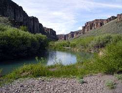 Battle Creek | |
| Country | United States |
|---|---|
| State | Idaho |
| County | Owyhee County, Idaho |
| Source | |
| - location | Owyhee County, Idaho |
| - elevation | 6,704 ft (2,043 m) [1] |
| - coordinates | 42°44′32″N 116°24′16″W / 42.74222°N 116.40444°W [2] |
| Mouth | Owyhee River |
| - location | west of Riddle, Owyhee County, Idaho |
| - elevation | 4,636 ft (1,413 m) [2] |
| - coordinates | 42°14′14″N 116°31′29″W / 42.23722°N 116.52472°WCoordinates: 42°14′14″N 116°31′29″W / 42.23722°N 116.52472°W [2] |
| Length | 67 mi (108 km) [3] |
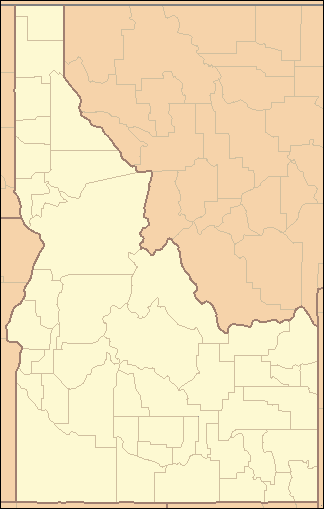  Location of the mouth of Battle Creek in Idaho
| |
Battle Creek is a 67-mile (110 km) long[3] tributary of the Owyhee River. Beginning at an elevation of 6,704 feet (2,043 m)[1] in central Owyhee County, Idaho, it flows generally south through the Owyhee Desert to its mouth west of Riddle,[4] at an elevation of 4,636 feet (1,413 m).[2] In 2009, 23.4 miles (37.7 km) of the creek were designated as wild by the Omnibus Public Land Management Act, which also created the Owyhee River Wilderness.[5][6]
See also
References
- 1 2 Source elevation derived from Google Earth search using GNIS source coordinates.
- 1 2 3 4 "Battle Creek". Geographic Names Information System. United States Geological Survey. June 21, 1979. Retrieved February 10, 2013.
- 1 2 "National Hydrography Dataset". United States Geological Survey. Retrieved February 10, 2013.
- ↑ Idaho Road and Recreation Atlas (Map) (2nd ed.). 1:250,000. Benchmark Maps. 2010. p. 80. ISBN 978-0-929591-06-3. OCLC 567571371.
- ↑ "Battle Creek, Idaho". National Wild and Scenic Rivers System. Retrieved February 10, 2013.
- ↑ "Owyhee River System". Bureau of Land Management. November 21, 2012. Retrieved February 10, 2013.
This article is issued from Wikipedia - version of the 9/11/2016. The text is available under the Creative Commons Attribution/Share Alike but additional terms may apply for the media files.