Burgersfort
| Burgersfort Tubatse Platinum City | |
|---|---|
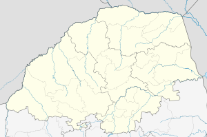  Burgersfort  Burgersfort  Burgersfort
| |
| Coordinates: 24°40′S 30°19′E / 24.667°S 30.317°ECoordinates: 24°40′S 30°19′E / 24.667°S 30.317°E | |
| Country | South Africa |
| Province | Limpopo |
| District | Sekhukhune |
| Municipality | Greater Tubatse |
| Area[1] | |
| • Total | 28.10 km2 (10.85 sq mi) |
| Population (2011)[1] | |
| • Total | 6,369 |
| • Density | 230/km2 (590/sq mi) |
| Racial makeup (2011)[1] | |
| • Black African | 65.6% |
| • Coloured | 3.2% |
| • Indian/Asian | 4.8% |
| • White | 25.8% |
| • Other | 0.6% |
| First languages (2011)[1] | |
| • Northern Sotho | 31.3% |
| • Afrikaans | 27.9% |
| • English | 16.8% |
| • Zulu | 3.8% |
| • Other | 20.1% |
| Postal code (street) | 1150 |
| PO box | 1150 |
| Area code | 013 |
Burgersfort is located in the valley of the Spekboom River [2] at the edge of the Bushveld Complex in the Greater Tubatse Local Municipality, near the border of the two provinces Limpopo and Mpumalanga. The town was named after a hexagonal fort built there during the 1876-77 Second War against the Bapedi of Chief Sekhukhune, and was named after President TF Burgers of the ZAR.[3] The region is rich in platinum and platinum group metals.[4] The town's neighbouring towns are Lydenburg (60 km), Steelpoort (16 km) and Ohrigstad (26 km).[5]
References
- 1 2 3 4 "Main Place Burgersfort". Census 2011.
- ↑ Fishing in Burgersfort, Mpumalanga, South Africa - Essential Travel Info
- ↑ http://www.bathroomrenovationspecialists.co.za/Burgersfort%20Index.htm[]
- ↑ "Archived copy". Archived from the original on 2007-02-23. Retrieved 2009-04-19.
- ↑ Routes Travel Info Portal: Burgersfort Archived May 21, 2010, at the Wayback Machine.
Municipalities and communities of Sekhukhune District Municipality | ||
|---|---|---|
District seat: Groblersdal | ||
| Elias Motsoaledi | .svg.png) | |
| Ephraim Mogale | ||
| Fetakgomo | ||
| Greater Tubatse | ||
| Makhuduthamaga | ||
This article is issued from Wikipedia - version of the 11/19/2016. The text is available under the Creative Commons Attribution/Share Alike but additional terms may apply for the media files.