Cedarville, KwaZulu-Natal
| Cedarville | |
|---|---|
  Cedarville  Cedarville  Cedarville
| |
| Coordinates: 30°23′17″S 29°2′28″E / 30.38806°S 29.04111°ECoordinates: 30°23′17″S 29°2′28″E / 30.38806°S 29.04111°E | |
| Country | South Africa |
| Province | Eastern Cape |
| District | Alfred Nzo |
| Municipality | Matatiele |
| Area[1] | |
| • Total | 12.40 km2 (4.79 sq mi) |
| Population (2011)[1] | |
| • Total | 4,412 |
| • Density | 360/km2 (920/sq mi) |
| Racial makeup (2011)[1] | |
| • Black African | 93.0% |
| • Coloured | 4.5% |
| • Indian/Asian | 0.2% |
| • White | 1.8% |
| • Other | 0.4% |
| First languages (2011)[1] | |
| • Xhosa | 78.1% |
| • Sotho | 6.3% |
| • Afrikaans | 5.8% |
| • English | 5.0% |
| • Other | 4.8% |
| Postal code (street) | 4730 |
| PO box | 4720 |
| Area code | 039 |
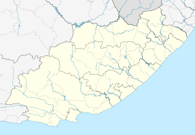
Cedarville is a town in the Alfred Nzo District Municipality of Eastern Cape, South Africa.
Village at the foot of the Cedarberg, 48 km north-west of Kokstad and 278 km from Pietermaritzburg. Named after the Cedarberg. In 1912 a village management board was established.[2]
References
- 1 2 3 4 "Main Place Cedarville". Census 2011.
- ↑ "Dictionary of Southern African Place Names (Public Domain)". Human Science Research Council. p. 113.
Municipalities and communities of Alfred Nzo District Municipality, Eastern Cape | ||
|---|---|---|
District seat: Mount Ayliff | ||
| Matatiele | .svg.png) | |
| Umzimvubu | ||
| Mbizana | ||
| Ntabankulu | ||
This article is issued from Wikipedia - version of the 8/17/2016. The text is available under the Creative Commons Attribution/Share Alike but additional terms may apply for the media files.