Chhatak Upazila
This article is about the Upazila of Chhatak. For the town of Chhatak, see Chhatak.
| Chhatak ছাতক | |
|---|---|
| Nickname(s): Suza | |
 | |
| Division | Sylhet Division |
| District | Sunamganj District |
| Government | |
| • MP (Sunamganj-5) | Muhibur Rahman Manik (Awami League) |
| Area | |
| • Total | 434.76 km2 (167.86 sq mi) |
| Population | |
| • Total | 273,153 |
| • Density | 628/km2 (1,630/sq mi) |
| Time zone | BST (UTC+6) |
| Postal code | 3080-93 |
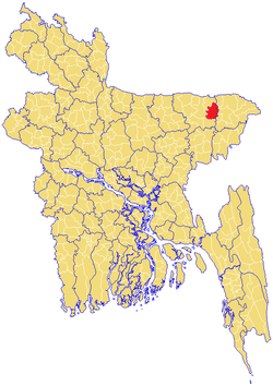
Chhatak (Bengali: ছাতক) is an Upazila of Sunamganj District in the Division of Sylhet, Bangladesh.[1]
Geography
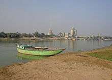
Surma River at Chhatak
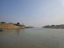
Piyain River at Chhatak
Chhatak is located at 25°02′30″N 91°40′30″E / 25.0417°N 91.6750°E. It has 43,727 households and total area 434.76 km².
Demographics
A the 1991 Bangladesh census, Chhatak had a population of 273,153. Males constituted 51.05% of the population and females 48.95%. Its adult (18+) population was 135,445. Chhatak had an average literacy rate of 24.5% (7+ years) compared with the national average of 32.4%.[2] Religious affiliation was: Muslim 83.08%, Hindu 16.75%, Buddhist, Christian and others 0.17%.
Administration
Chhatak has 13 Unions/Wards, 316 Mauzas/Mahallas and 530 villages.
See also
- Chhatak
- Upazilas of Bangladesh
- Districts of Bangladesh
- Divisions of Bangladesh
- Khola Gaon
- Mahammedpur
- Jhigli
References
 |
Wikimedia Commons has media related to Chhatak Upazila. |
- ↑ Ashfaq Hossain (2012), "Chhatak Upazila", in Sirajul Islam and Ahmed A. Jamal, Banglapedia: National Encyclopedia of Bangladesh (Second ed.), Asiatic Society of Bangladesh
- ↑ "Population Census Wing, BBS.". Archived from the original on 27 March 2005. Retrieved November 10, 2006.
| Upazila/Thana: |  | |
|---|---|---|
| Upazilas of the Sylhet Division | ||
|---|---|---|
Capital: Sylhet | ||
| Habiganj District | 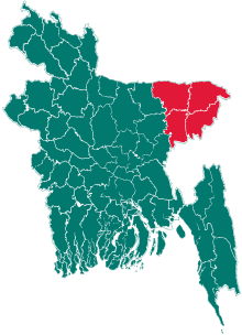 | |
| Moulvibazar District | ||
| Sunamganj District | ||
| Sylhet District | ||
This article is issued from Wikipedia - version of the 11/8/2016. The text is available under the Creative Commons Attribution/Share Alike but additional terms may apply for the media files.