Chillagoe-Mungana Caves National Park
| Chillagoe-Mungana Caves National Park Queensland | |
|---|---|
|
IUCN category II (national park) | |
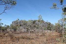 2014 | |
  Chillagoe-Mungana Caves National Park | |
| Nearest town or city | Chillagoe |
| Coordinates | 17°05′30″S 144°23′35″E / 17.09167°S 144.39306°ECoordinates: 17°05′30″S 144°23′35″E / 17.09167°S 144.39306°E |
| Established | 1995 |
| Area | 36.9 km2 (14.2 sq mi) |
| Managing authorities | Queensland Parks and Wildlife Service |
| Website | Chillagoe-Mungana Caves National Park |
| See also | Protected areas of Queensland |
Chillagoe-Mungana Caves is a national park in Queensland, Australia, 1455 km northwest of Brisbane.[1]
The park is located within the Walsh River catchment area and the Einasleigh Uplands bioregion.[2] A total of 10 rare or threatened species have been recorded in the park.[2]
There are several self-guided limestone caves, the Archways, Pompeii cave, and Bauhinia cave. The historic Chillagoe smelters area has mining relics from the 1890s. There are a few small rock galleries of Indigenous Australian art.
Camping is not permitted.[3]
See also
References
- ↑ "Things to See and Do". Queensland Holidays. Retrieved 2013-12-25.
- 1 2 "Chillagoe-Mungana Caves National Park". WetlandInfo. Department of Environment and Heritage Protection. Retrieved 20 March 2016.
- ↑ "About Chillagoe". Department of National Parks, Sport and Racing. 13 December 2014. Retrieved 20 March 2016.
This article is issued from Wikipedia - version of the 4/4/2016. The text is available under the Creative Commons Attribution/Share Alike but additional terms may apply for the media files.