Cracow, Queensland
| Cracow Queensland | |||||||||||||
|---|---|---|---|---|---|---|---|---|---|---|---|---|---|
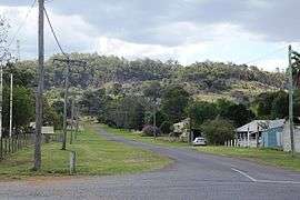 Third Avenue, Cracow, 2014 | |||||||||||||
  Cracow | |||||||||||||
| Coordinates | 25°17′0″S 150°18′0″E / 25.28333°S 150.30000°ECoordinates: 25°17′0″S 150°18′0″E / 25.28333°S 150.30000°E | ||||||||||||
| Population | 196 (2011 census)[1] | ||||||||||||
| Established | 1931 | ||||||||||||
| Postcode(s) | 4719 | ||||||||||||
| Location |
| ||||||||||||
| LGA(s) | Banana Shire Council | ||||||||||||
| State electorate(s) | Callide | ||||||||||||
| Federal Division(s) | Flynn | ||||||||||||
| |||||||||||||
Cracow is a gold mining town and locality in Queensland, Australia, in the Banana Shire local government area.[2][3] The town is located on the Theodore – Eidsvold road, 485 kilometres (301 mi) north west of the state capital, Brisbane. At the 2011 census, Cracow and the surrounding area had a population of 196.[1]
History
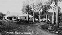
The town was named for a pastoral run, named in 1851 by pastoralist, John Ross, for the Polish city of Kraków which had made a brave stand for independence.[2][4]
Gold was first discovered in Cracow in 1875 by itinerant fossickers and a further discovery of a nugget was made by an Aboriginal man in 1916. In 1931, the Golden Plateau mine was established and it operated continuously until 1976.[5]
Cracow Post Office opened on 1 October 1932.[6]
At its gold mining peak, the town included five cafes, barber shop, billiard saloon, two butchers, a picture theatre and a soft drink factory.[7] The closure of the mine led to Cracow becoming a ghost town with many deserted houses and shops.
In 2004, Newcrest Mining reestablished gold mining in the town, leading to hopes the town may recover.[7]

Facilities
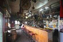
The local hotel is one of the only remaining retail business, as it attracts a lot of tourists due to its unusual array of strange artifacts adorning the ceilings and walls. The other business was the General Store, which doubled as a post office and video store.
Events
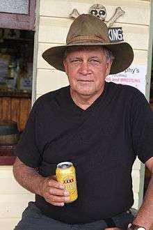
Every year, Cracow hosts Fred Brophy's Boxing Tent.[8]
References
- 1 2 Australian Bureau of Statistics (31 October 2012). "Cracow (Banana Shire) (State Suburb)". 2011 Census QuickStats. Retrieved 2016-04-03.
- 1 2 "Cracow (town) (entry 8648)". Queensland Place Names. Queensland Government. Retrieved 21 May 2014.
- ↑ "Cracow (locality) (entry 40425)". Queensland Place Names. Queensland Government. Retrieved 21 May 2014.
- ↑ "NOMENCLATURE OF QUEENSLAND—100.". The Courier-Mail. Brisbane: National Library of Australia. 24 January 1936. p. 12. Retrieved 20 May 2014.
- ↑ Beattie, Ross. "Cracow". Ross Beattie's Localities pages. Archived from the original on 25 October 2009. Retrieved 2007-07-20.
- ↑ Premier Postal History. "Post Office List". Premier Postal Auctions. Retrieved 10 May 2014.
- 1 2 Lee, Tim (2006-02-23). "Old gold town revels in resources boom". Landline. Australian Broadcasting Corporation. Retrieved 2007-02-13.
- ↑ "Simple Pleasures: Banana Shire" (PDF). The Gladstone Region. Tourism Queensland. p. 3. Retrieved 8 June 2014.
External links
 Media related to Cracow, Queensland at Wikimedia Commons