Craigmont, Ontario
| Craigmont | |
|---|---|
|
Dispersed Rural Community Unincorporated area | |
|
Craigmont with Mount Robillard in the background | |
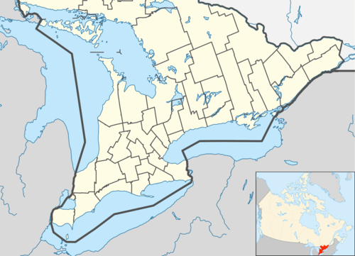  Craigmont Location in southern Ontario | |
| Coordinates: 45°17′45″N 77°38′06″W / 45.29583°N 77.63500°WCoordinates: 45°17′45″N 77°38′06″W / 45.29583°N 77.63500°W[1] | |
| Country | Canada |
| Province | Ontario |
| County | Hastings |
| Municipality | Carlow/Mayo |
| Elevation[2] | 338 m (1,109 ft) |
| Time zone | Eastern Time Zone (UTC-5) |
| • Summer (DST) | Eastern Time Zone (UTC-4) |
| Postal Code | K0L |
| Area code(s) | 613, 343 |
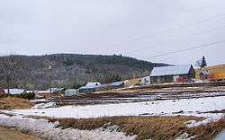
Craigmont is a Dispersed Rural Community, unincorporated place, and ghost town in Carlow/Mayo, Hastings County in Central Ontario, Canada. It lies adjacent to the municipal boundary with Brudenell, Lyndoch and Raglan in Renfrew County. It was a former mining town that produced corundum from deposits in Mount Robillard, directly north of the community.
In 1876, the mountain was discovered as a source for Corundum. In 1900, mining operations began by the Canada Corundum Company. A settlement, consisting of both a company town and a private town, grew to a peak population of 600 persons, making it the world's largest Corundum producer at that time. But in 1913, a fire destroyed the mill, resulting in job loss and a gradual decline. By 1921, Craigmont was a ghost town.
A small community remains along County Road 517 (the former Ontario Highway 517), with some of the original buildings and ruins on private property.
References
- ↑ "Craigmont". Geographical Names Data Base. Natural Resources Canada. Retrieved 2014-08-17. (community)
- ↑ Taken from Google Earth at geographic coordinates, accessed 2014-08-17.
Other map sources:
- Map 10 (PDF) (Map). 1 : 700,000. Official road map of Ontario. Ministry of Transportation of Ontario. 2010-01-01. Retrieved 2014-08-17.
- Restructured municipalities - Ontario map #5 (Map). Restructuring Maps of Ontario. Ontario Ministry of Municipal Affairs and Housing. 2006. Retrieved 2014-08-17.
External links
- Michal Adamowicz, "Craigmont Mine, the Mountain of Corundum in Ontario", photo essay (2008)
- Ghosttowns.com - Craigmont ghost town
- Ontario Abandoned Places - Craigmont