Crawfordsville Bridge
|
Crawfordsville Bridge | |
|
The Crawfordsville Covered Bridge crosses the Calapooia River | |
   | |
| Location | SR 228, Crawfordsville, Oregon |
|---|---|
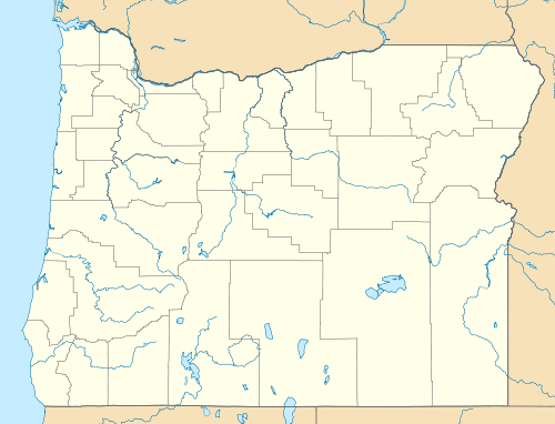
| Coordinates | 44°21′28″N 122°51′32″W / 44.35778°N 122.85889°WCoordinates: 44°21′28″N 122°51′32″W / 44.35778°N 122.85889°W |
| Area | 0.2 acres (0.081 ha) |
| Built | 1932 |
| Architectural style | No Style Listed, Howe Truss |
| MPS | Oregon Covered Bridges TR |
| NRHP Reference # | 79002115[1] |
| Added to NRHP | November 29, 1979 |
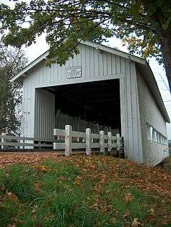
The Crawfordsville Bridge spans the Calapooia River adjacent to Oregon Route 228 near the community of Crawfordsville in Linn County, Oregon, United States.[2]
The 105-foot Howe truss type bridge was built in 1932. The bridge was bypassed in 1963 and is now maintained by the Linn County Parks & Recreation Department as a pedestrian bridge across the river. Since 1990, the bridge has been the site of a Bridge Day festival held annually in the summer.[3] A small park next to the bridge includes a picnic table and fire pit.[2]
The bridge was featured in the 1976 television movie, The Flood.[4]
The bridge is listed on the National Register of Historic Places.[5]
See also
References
- ↑ National Park Service (2010-07-09). "National Register Information System". National Register of Historic Places. National Park Service.
- 1 2 "Linn County Parks & Recreation - Crawfordsville Covered Bridge Wayside". Retrieved February 20, 2012.
- ↑ "Homecoming, bridge day slated in Crawfordsville". democratherald.com. August 16, 2010. Retrieved February 20, 2012.
- ↑ "Calapooia River (Crawfordsville)" (PDF). www.oregon.gov. Retrieved February 20, 2012.
- ↑ "Oregon National Register List" (PDF). Oregon Parks and Recreation Department. June 6, 2011. Retrieved February 21, 2012.
External links
 Media related to Crawfordsville Bridge at Wikimedia Commons
| Topics | |
|---|---|
| Lists by states |
|
| Lists by insular areas | |
| Lists by associated states | |
| Other areas | |
| |


This article is issued from Wikipedia - version of the 11/29/2016. The text is available under the Creative Commons Attribution/Share Alike but additional terms may apply for the media files.