Crnokosa
For the basketball club, see KK Crnokosa.
| Crnokosa | |
|---|---|
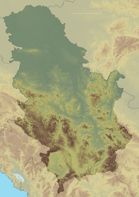  Crnokosa Location in Serbia | |
| Highest point | |
| Elevation | 809 m (2,654 ft) [1] |
| Coordinates | 43°58′03″N 19°54′59″E / 43.96750°N 19.91639°ECoordinates: 43°58′03″N 19°54′59″E / 43.96750°N 19.91639°E |
| Geography | |
| Location | Western Serbia |
Crnokosa[2] (Serbian Cyrillic: Црнокоса) is a mountain in western Serbia, near the town of Kosjerić. Its highest peak Šarampov has an elevation of 809 m (2,654 ft) above sea level. It runs around 9 km along the Skrapež river, steeply closing its southern valley, while its southern slopes are milder.
References
- ↑ Jovan Đokić. "Katalog planina Srbije". PSD Kopaonik Beograd. Archived from the original on May 18, 2011.
- ↑ "Geografija Kosjerića". Retrieved 2010-10-15.
This article is issued from Wikipedia - version of the 9/13/2016. The text is available under the Creative Commons Attribution/Share Alike but additional terms may apply for the media files.