Cygnet River, South Australia
| Cygnet River South Australia | |||||||||||||
|---|---|---|---|---|---|---|---|---|---|---|---|---|---|
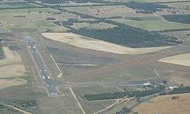 Kingscote Airport and the adjoining land use as viewed from the north | |||||||||||||
  Cygnet River | |||||||||||||
| Coordinates | 35°41′54″S 137°31′10″E / 35.69828°S 137.519580°ECoordinates: 35°41′54″S 137°31′10″E / 35.69828°S 137.519580°E | ||||||||||||
| Population | 257 (shared with other localities within the “State Suburb of Menzies”) (2011 census)[1][lower-alpha 1] | ||||||||||||
| Established | 2002[2] | ||||||||||||
| Postcode(s) | 5223[3] | ||||||||||||
| Elevation | 6 m (20 ft)[4] | ||||||||||||
| Time zone | ACST (UTC+9:30) | ||||||||||||
| • Summer (DST) | ACST (UTC+10:30) | ||||||||||||
| Location |
| ||||||||||||
| LGA(s) | Kangaroo Island Council | ||||||||||||
| State electorate(s) | Finniss[5] | ||||||||||||
| Federal Division(s) | Mayo[6] | ||||||||||||
| |||||||||||||
| |||||||||||||
| Footnotes |
Distances[3][2] Coordinates[2] Climate[4] Adjoining localities[2] | ||||||||||||
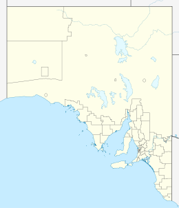
Cygnet River is a locality in the Australian state of South Australia located on Kangaroo Island about 192 kilometres (119 mi) south-west of the Adelaide city centre and about 12 kilometres (7.5 mi) for the centre of Kingscote.[3]
Its boundaries were created in 2002 in respect to “the long established name” which is reported to be derived from the stream located within its boundaries.[2]
The major land use within the locality is primary production.[7] The locality also includes the Kingscote Airport and the Cygnet Estuary Conservation Park.[7][2]
Cygnet River contains the following places listed on the South Australian Heritage Register - the Farm and Eucalyptus Oil Distillery Ruins, Duck Lagoon and the Dwelling & Eucalyptus Oil Distillery Ruins (Cygnet River).[8][9]
Cygnet River is located within the federal division of Mayo, the state electoral district of Finniss and the local government area of the Kangaroo Island Council.[6][5][2]
See also
References
- Notes
- ↑ For the 2011 census, the ‘State Suburb of Menzies’ consisted of the localities of Cassini, Cygnet River, Menzies and Stokes Bay.
- Citations
- ↑ Australian Bureau of Statistics (31 October 2012). "Menzies". 2011 Census QuickStats. Retrieved 10 March 2016.
- 1 2 3 4 5 6 7 "Search result for "Cygnet River (Locality Bounded)" (Record no SA0017630) with the following layer being selected - "Suburbs and Localities"". Property Location Browser. Department of Planning, Transport and Infrastructure. Retrieved 10 March 2016.
- 1 2 3 "Cygnet River, South Australia (Postcode)". postcodes-australia.com. Retrieved 10 March 2016.
- 1 2 "Monthly climate statistics: Summary statistics KINGSCOTE AERO". Commonwealth of Australia , Bureau of Meteorology. Retrieved 8 March 2016.
- 1 2 "District of Finniss Background Profile". ELECTORAL COMMISSION SA. Retrieved 2 August 2015.
- 1 2 "Federal electoral division of Mayo, boundary gazetted 16 December 2011" (PDF). Australian Electoral Commission. Retrieved 2 August 2015.
- 1 2 "Development Plan, Kangaroo Island Council" (PDF). Department of Planning, Transport and Infrastructure. pp. 159, 260, 282 & 287. Retrieved 8 March 2016.
- ↑ "Farm and Eucalyptus Oil Distillery Ruins, Duck Lagoon". South Australian Heritage Register. Department of Environment, Water and Natural Resources. Retrieved 1 June 2016.
- ↑ "Dwelling & Eucalyptus Oil Distillery Ruins". South Australian Heritage Register. Department of Environment, Water and Natural Resources. Retrieved 1 June 2016.