Dalveen, Queensland
| Dalveen Queensland | |||||||||||||
|---|---|---|---|---|---|---|---|---|---|---|---|---|---|
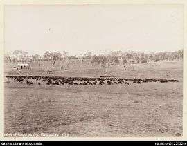 Mob of black sheep, Braeside Homestead, 1894 | |||||||||||||
  Dalveen | |||||||||||||
| Coordinates | 28°29′9.6″S 151°58′15.6″E / 28.486000°S 151.971000°ECoordinates: 28°29′9.6″S 151°58′15.6″E / 28.486000°S 151.971000°E | ||||||||||||
| Population | 346 (2011 census)[1] | ||||||||||||
| • Density | 0.7502/km2 (1.9431/sq mi) | ||||||||||||
| Postcode(s) | 4374 | ||||||||||||
| Area | 461.2 km2 (178.1 sq mi)[2] | ||||||||||||
| Time zone | AEST (UTC+10) | ||||||||||||
| Location | |||||||||||||
| LGA(s) | Southern Downs Region | ||||||||||||
| Federal Division(s) | Maranoa[3] | ||||||||||||
| |||||||||||||
Dalveen is a small rural town in the Southern Downs Region, Queensland, Australia.[4] At the 2011 census the town recorded a population of 346.[1]
History
The name Dalveen derives from locality name given by settler John Flint, who named it after a pass in Lanark, Scotland.[4]
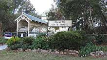
Stanthorpe Road Provisional School opened on 12 August 1878. In 1879 it was renamed North Maryland Provisional School. In 1892 it was renamed Dalveen State School on 18 January 1892.[5][6]
Cherry Gully Post Office opened on 1 January 1880 and was replaced by Dalveen Post Office in 1881.[7]
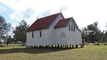
St Barnabas Anglican Church was built in 1903.[8]
Heritage listings
Dalveen has a number of heritage-listed sites, including:
- 28 Crystal Mountain Road: Braeside Homestead[9]
- Warwick-to-Wallangarra railway line: Dalveen Tunnel[10]
Facilities
St Barnabas Anglican Church holds a service on the 4th Sunday of each month.[8]
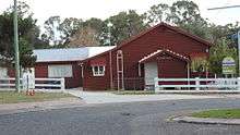
The Dalveen public hall and Dalveen State School are both in Pine Crescent.[11]
Transport

The New England Highway passes north-south through Dalveen.[11]
The Southern railway line passes through Dalveen; the hilly terrain necessitated two tunnels known as the Dalveen Tunnel and the Cherry Gully Tunnel and a rail bridge over Old Stanthorpe Road.[11] The line is no longer in active service.
Notable residents
- William Allan, Member of the Queensland Legislative Assembly, Member of the Queensland Legislative Council, owner of Braeside Homestead
References
- 1 2 Australian Bureau of Statistics (31 October 2012). "Dalveen (State Suburb)". 2011 Census QuickStats. Retrieved 11 December 2013.
- ↑ Australian Bureau of Statistics (31 October 2012). "2011 Community Profiles: Dalveen (State Suburb)". 2011 Census of Population and Housing. Retrieved 11 December 2013.
- ↑ "Maranoa". Australian Electoral Commission. 11 December 2013. Retrieved 11 December 2013.
- 1 2 "Dalveen (entry 9256)". Queensland Place Names. Queensland Government. Retrieved 13 September 2015.
- ↑ "Opening and closing dates of Queensland Schools". Queensland Government. Retrieved 4 June 2015.
- ↑ "Agency ID5156, Dalveen State School". Queensland State Archives. Retrieved 5 June 2015.
- ↑ Premier Postal History. "Post Office List". Premier Postal Auctions. Retrieved 10 May 2014.
- 1 2 Spence, Kay. "Dalveen 4374". Retrieved 5 June 2015.
- ↑ "Braeside Homestead (entry 602351)". Queensland Heritage Register. Queensland Heritage Council. Retrieved 13 July 2013.
- ↑ "Dalveen Tunnel (entry 601519)". Queensland Heritage Register. Queensland Heritage Council. Retrieved 13 July 2013.
- 1 2 3 "Dalveen, Queensland". Google Maps. Retrieved 5 June 2015.
External links
 Media related to Dalveen, Queensland at Wikimedia Commons