Datong Hui and Tu Autonomous County
| Datong Hui and Tu Autonomous County | |
|---|---|
| County | |
| Chinese transcription(s) | |
| • Chinese | 大通回族土族自治县 |
| • Pinyin | Dàtōng Huízú Tǔzú Zìzhìxiàn |
| • Xiao'erjing | دَاتْو خُوِذُو تُوذُو ذِجِشِیًا |
|
Looking west over Datong town from Mt Laoye | |
.png) Location of the county | |
| Country | China |
| Province | Qinghai |
| Prefecture | Xining |
| Elevation | 2,442 m (8,012 ft) |
| Time zone | China Standard (UTC+8) |
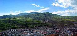
Datong Hui and Tu Autonomous County (simplified Chinese: 大通回族土族自治县; traditional Chinese: 大通回族土族自治縣; pinyin: Dàtōng Huízú Tǔzú Zìzhìxiàn; Xiao'erjing: دَاتْو خُوِذُو تُوذُو ذِجِشِیًا) is a county of Qinghai Province, China. It is under the administration of Xining city.
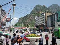
"Mount Laoye" as seen from Datong
Since 2009 a folk music "Flower Festival" has been held annually in late July on "Mount Laoye" (2928 m) in Datong town.[1]
Transportation
- China National Highway 227
- Xining-Datong Expressway (Ningda Expressway)
- Xining-Datong Railway (Ningda Railway, 宁大铁路), a 39-km long dead-end railway branch constructed in 1966-1968 and primarily serving a local coal mine. In the past, passenger service operated on that line, but ceased in 2008.
- Lanzhou–Xinjiang High-Speed Railway (Datong West Station; 36°57′58″N 101°40′19″E / 36.966168°N 101.672054°E), opened in December 2014. Very limited service.
See also
References
Coordinates: 37°05′38″N 101°27′32″E / 37.0939°N 101.459°E
This article is issued from Wikipedia - version of the 11/27/2015. The text is available under the Creative Commons Attribution/Share Alike but additional terms may apply for the media files.