Del Rosa, San Bernardino, California
| Del Rosa, San Bernardino, California | |
|---|---|
| Neighborhood community | |
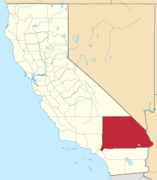
  Location of Del Rosa in California | |
| Coordinates: 34°08′48″N 117°14′37″W / 34.14667°N 117.24361°WCoordinates: 34°08′48″N 117°14′37″W / 34.14667°N 117.24361°W | |
| Country | United States |
| State | California |
| City | San Bernardino |
| Elevation[1] | 1,291 ft (393 m) |
| Time zone | PST (UTC-8) |
| • Summer (DST) | PDT (UTC-7) |
| [2] | |
Del Rosa is a neighborhood community in the city of San Bernardino, California. [3]
History
Del Rosa is derived from a Spanish phrase meaning "of the rose".[4]
Geography
Del Rosa is located 2 miles (3.2 km) east of downtown San Bernardino in San Bernardino County, California.[5] The coordinates are 34.853N, -117.13W, and the elevation is 1,321 feet, and it is in the Pacific Time Zone (UTC-8, UTC-7 in the summer).
Climate
Del Rosa has a Continental Mediterranean climate. It experiences average winters and hot, dry summers.
References
- ↑ U.S. Geological Survey Geographic Names Information System: Del Rosa, California. Retrieved on 2008-07-10.
- ↑ "Del Rosa CA". ZIP Code Lookup. Retrieved 2008-07-10.
- ↑ http://california.hometownlocator.com/ca/san-bernardino/del-rosa.cfm Del Rosa (in San Bernardino County, CA) Populated Place Profile on california hometownlocator
- ↑ Gannett, Henry (1905). The Origin of Certain Place Names in the United States. Govt. Print. Off. p. 103.
- ↑ http://www.mapquest.com/maps?city=Del+Rosa&state=CA Map of Del Rosa
| Topics |  | |
|---|---|---|
| Areas | ||
| Transportation | ||
| Points of interest | ||
| Higher education | ||
This article is issued from Wikipedia - version of the 10/14/2016. The text is available under the Creative Commons Attribution/Share Alike but additional terms may apply for the media files.