Delduar Upazila
| Delduar দেলদুয়ার | |
|---|---|
| Upazila | |
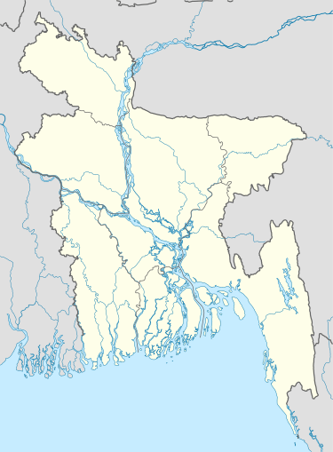  Delduar Location in Bangladesh | |
| Coordinates: 24°8.5′N 89°58′E / 24.1417°N 89.967°ECoordinates: 24°8.5′N 89°58′E / 24.1417°N 89.967°E | |
| Country |
 Bangladesh Bangladesh |
| Division | Dhaka Division |
| District | Tangail District |
| Area | |
| • Total | 184.54 km2 (71.25 sq mi) |
| Population (2011) | |
| • Total | 207,278 |
| • Density | 1,100/km2 (2,900/sq mi) |
| Time zone | BST (UTC+6) |
| Website | Official Website of Delduar |
Delduar (Bengali: দেলদুয়ার) is an Upazila of Tangail District[1] in the Division of Dhaka, Bangladesh.
Geography
Delduar is located at 24°08′30″N 89°58′00″E / 24.1417°N 89.9667°E . It has 32696 households and total area 184.54 km².
Demographics
As of the 2011 Bangladesh census, Delduar has a population of 207278. Males constitute 50.46% of the population, and females 49.54%.Delduar has an average literacy rate of 40.5% (7+ years).[2]
Administration
Delduar has 8 Unions/Wards, 130 Mauzas/Mahallas, and 166 villages.
The Union Parishads are-
- Delduar Union
- Lauhati Union
- Dubail Union
- Pathrail Union
- Atia Union
- Elashin Union
- Fazilhati Union
- Deoli Union
See also
References
- ↑ Tapan Kumar De (2012), "Delduar Upazila", in Sirajul Islam and Ahmed A. Jamal, Banglapedia: National Encyclopedia of Bangladesh (Second ed.), Asiatic Society of Bangladesh
- ↑ "Population Census Wing, BBS.". Archived from the original on 2005-03-27. Retrieved November 10, 2006.
| Upazila/Thana: | | |
|---|---|---|
This article is issued from Wikipedia - version of the 11/10/2016. The text is available under the Creative Commons Attribution/Share Alike but additional terms may apply for the media files.