Durlabhpur
| Durlabhpur | |
|---|---|
| Village | |
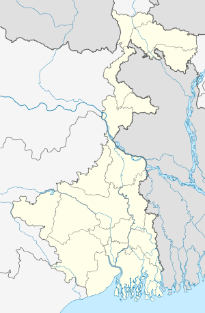  Durlabhpur   Durlabhpur Location in West Bengal, India | |
| Coordinates: 23°28′12.0″N 87°07′48.0″E / 23.470000°N 87.130000°ECoordinates: 23°28′12.0″N 87°07′48.0″E / 23.470000°N 87.130000°E | |
| Country |
 India India |
| State | West Bengal |
| District | Bankura |
| Population (2011) | |
| • Total | 1,725 |
| Languages | |
| • Official | Bengali, English |
| Time zone | IST (UTC+5:30) |
| Lok Sabha constituency | Bankura |
| Vidhan Sabha constituency | Saltora |
| Website |
bankura |
Durlabhpur is a village in Gangajalghati CD Block in Bankura Sadar subdivision of Bankura district in the state of West Bengal, India.
Demographics
As per 2011 Census of India Durlabhpur had a total population of 1,725 of which 894 (52%) were males and 831 (48%) were females. Population below 6 years was 172. The total number of literates in Durlabhpur was 1086 (69.93% of the population over 6 years).[1]
Economy
Power
In 1996, Mejia Thermal Power Station was set up by Damodar Valley Corporation at Durlabhpur. It has an installed capacity of 2340 MW – 4 units of 210 MW each, 2 units of 250 MW each and 2 units of 500 MW each.[2]
Transport
NH 14, (old numbering NH 60), running from Morgram to Kharagpur, and Durgapur-Purulia Road pass through Durlavpur.[3][4]
References
- ↑ "2011 Census – Primary Census Abstract Data Tables". West Bengal – District-wise. Registrar General and Census Commissioner, India. Retrieved 14 October 2016.
- ↑ "Damodar Valley Corporation". Generating Units. DVC. Retrieved 25 August 2016.
- ↑ "Rationalisation of Numbering Systems of National Highways" (PDF). New Delhi: Department of Road Transport and Highways. Retrieved 5 August 2016.
- ↑ Google maps
Cities, towns and locations in Bankura District | |||||||||||
|---|---|---|---|---|---|---|---|---|---|---|---|
| Cities, municipal and census towns |
| ||||||||||
| Locations other than cities and towns |
| ||||||||||
| Related topics |
| ||||||||||

