Exeter, Tasmania
| Exeter Launceston, Tasmania | |
|---|---|
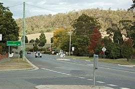 West Tamar Highway at Exeter | |
  Exeter | |
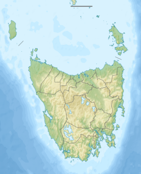
| Coordinates | 41°17′59″S 146°57′11″E / 41.29972°S 146.95306°ECoordinates: 41°17′59″S 146°57′11″E / 41.29972°S 146.95306°E |
| Population | 389 (2011 census)[1] |
| • Density | 121.6/km2 (315/sq mi) |
| Postcode(s) | 7275 |
| Area | 3.2 km2 (1.2 sq mi)[2] |
| Time zone | AEST (UTC+10) |
| • Summer (DST) | AEDT (UTC+11) |
| Location |
|
| Federal Division(s) | Lyons[3] |
Exeter is a small town approximately 24 kilometres north of the city of Launceston, Tasmania, Australia. At the 2011 census, Exeter had a population of 389.[1]
It is an important town agriculturally due to its positioning in the centre of a large rural area known for its orchards, dairy and beef cattle, fruit produce and sheep herds.
Features
The Exeter Methodist Church is a timber building that was completed in 1861, being the oldest Methodist Church in Tasmania. Brady's Lookout is 5 km (3 mi) south of Exeter on the West Tamar Highway. It was used by the infamous bushranger Matthew Brady to identify potential victims below.
Education
Exeter High School is a comprehensive secondary school located on Glen-Ard-Mohr Road.[4] It was established in 1985, following a reorganisation of the earlier Exeter District High School.[5]
References
- 1 2 Australian Bureau of Statistics (31 October 2012). "Exeter (L) (Tas.) (Urban Centre/Locality)". 2011 Census QuickStats. Retrieved 11 December 2013.
- ↑ Australian Bureau of Statistics (31 October 2012). "2011 Community Profiles: Exeter (L) (Tas.) (Urban Centre/Locality)". 2011 Census of Population and Housing. Retrieved 11 December 2013.
- ↑ "Lyons". Australian Electoral Commission. Retrieved 11 December 2013.
- ↑ "Exeter High School", Department of Education (Tasmania), accessed 21 July 2008
- ↑ "Exeter District High School", Archives Office of Tasmania, accessed 21 July 2008
 Media related to Exeter, Tasmania at Wikimedia Commons