Flinders Ranges Way
| Flinders Ranges Way South Australia | ||||
|---|---|---|---|---|
  south end north end | ||||
| Coordinates |
| |||
| General information | ||||
| Type | Rural road | |||
| Length | 209 km (130 mi)[1] | |||
| Route number(s) | B83 Stirling North to Hawker | |||
| Major junctions | ||||
| south end | ||||
| north end | Blinman | |||
| Location(s) | ||||
| Major settlements | ||||
| Highway system | ||||
|
Highways in Australia National Highway • Freeways in Australia Highways in South Australia | ||||
| ||||
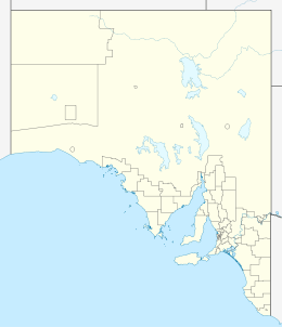
The Flinders Ranges Way (route B83) is the main road route through the Flinders Ranges in South Australia. It starts from the Augusta Highway at Stirling North, 6 km southeast of Port Augusta. The Flinders Ranges Way extends 209 km to Blinman.[2] Route B83 follows the Flinders Ranges Way through Quorn to Hawker, but then branches onto the Barndioota Road along the western side of the ranges through Leigh Creek to Lyndhurst.[1]
Major junctions
| LGA[3] | Location[3] | km[1] | mi | Destinations[1][3] | Notes |
|---|---|---|---|---|---|
| Port Augusta | Stirling North | 0 | 0.0 |  Augusta Highway – Port Augusta Augusta Highway – Port Augusta | southern terminus of Flinders Ranges Way |
| Flinders Ranges Council | Quorn | 33 | 21 | Horrocks Highway – Wilmington | |
| 10km south of Hawker | 90 | 56 |  RM Williams Way – Orroroo RM Williams Way – Orroroo | ||
| Hawker | 100 | 62 |  Barndioota Road – Leigh Creek Barndioota Road – Leigh Creek | ||
| Outback Communities Authority | Blinman | 209 | 130 |
| northern terminus of Flinders Ranges Way |
| |||||
References
- 1 2 3 4 Google (12 September 2014). "Flinders Ranges Way" (Map). Google Maps. Google. Retrieved 12 September 2014.
- ↑ "Property Location Browser". Department for Planning, Transport and Infrastructure. Retrieved 12 September 2014.
- 1 2 3 A.J.Miazzo (16 December 2013). "Naming of State Rural Roads - Mid North" (PDF). Government of South Australia. Rack Plan 869. Retrieved 17 September 2014.
Road infrastructure in South Australia | ||
|---|---|---|
| Freeways |  | |
| Interstate highways | ||
| State highways | ||
| Arterial roads |
| |
| Outback tracks | ||
This article is issued from Wikipedia - version of the 5/12/2016. The text is available under the Creative Commons Attribution/Share Alike but additional terms may apply for the media files.