Gambaga Witch camp
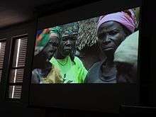
Gambaga Witch camp is a segregated community within Gambaga township in the Northern Region of Ghana established in the 18th century to accommodate alleged witches and wizards who are banished from their communities.[1][2][3]
The camp has about 25 round huts, and holds about 100 women. No health services or indoor plumbing are available.[4]
Many women in Ghana's witch camps are widows and it is thought that relatives accused them of witchcraft in order to take control of their husbands' possessions.[5] Many women also are mentally ill, a little understood problem in Ghana.[5] In Gambaga, the women are given protection by the local chieftain and in return, pay him and work in his fields.[6]
See also
References
- ↑ de Trey-White, Simon (June 23, 2007). "The Witches of Gambaga: Belief in Witchcraft Is Still Widespread in Africa, and Being Accused of Its Practice Can Be a Death Sentence. and with Traditional Gender Roles Being Challenged, Such Accusations Are Becoming Increasingly Common. Simon De Trey-White Visits a Camp in Ghana That Has Housed 'Convicted' Witches for More Than 200 Years". Geographical. Retrieved 21 November 2014 – via HighBeam.(Subscription required.)
- ↑ Sullivan, Tim (11 January 1998). "A Prison Sometimes a Haven: Ghana's Witch Villages Only Safe Place for Women Accused of Casting Spells". Associated Press. Rocky Mountain News (Denver, CO). Retrieved 21 November 2014 – via HighBeam.(Subscription required.)
- ↑ Djanie, Akua (January 1, 2013). "Africa for Halloween?". New African. Retrieved 21 November 2014 – via HighBeam.(Subscription required.)
- ↑ Npong, Francis (2014). "Witch Camps of Ghana". Utne Reader (Winter): 48–49. Retrieved 10 January 2015.
- 1 2 "Ghana witch camps: Widows' lives in exile". BBC. 1 September 2012. Retrieved September 1, 2012.
- ↑ "Ghana: the Witches of Gambaga". London: Yaba Badoe. 25 November 2010. Retrieved September 1, 2012.
External links
- Video by Yaba Badoe about women in Ghanaian camps
- Dispatches Saving Africa's Witch Children
- Witch Child Documentary
Coordinates: 10°31′50″N 0°26′32″W / 10.53056°N 0.44222°W