Gilpin Peak
| Gilpin Peak | |
|---|---|
.jpg) Gilpin Peak and Wright Lake | |
| Highest point | |
| Elevation | 13,700 ft (4,176 m) [1][2] |
| Prominence | 720 ft (219 m) [2] |
| Isolation | 1.20 mi (1.93 km) [2] |
| Parent peak | Mount Sneffels[2] |
| Coordinates | 37°59′12″N 107°47′35″W / 37.9866601°N 107.7931174°WCoordinates: 37°59′12″N 107°47′35″W / 37.9866601°N 107.7931174°W [3] |
| Geography | |
  Gilpin Peak | |
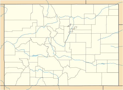
| Location | Ouray and San Miguel counties, Colorado, United States[3] |
| Parent range |
San Juan Mountains, Sneffels Range[2] |
| Topo map |
USGS 7.5' topographic map Grays Peak, Colorado[3] |
Gilpin Peak is a high mountain summit in the Sneffels Range of the Rocky Mountains of North America. The 13,700-foot (4,176 m) thirteener is located in the Mount Sneffels Wilderness of Uncompahgre National Forest, 3.5 miles (5.6 km) north-northeast (bearing 23°) of the Town of Telluride, Colorado, United States, on the drainage divide between Ouray County and San Miguel County.[1][2][3] Gilpin Peak was named in honor of William Gilpin, the first Governor of the Territory of Colorado.[4]
See also
- List of Colorado mountain ranges
- List of Colorado mountain summits
- List of Colorado county high points
References
- 1 2 The elevation of Gilpin Peak includes an adjustment of +1.859 m (+6.10 ft) from NGVD 29 to NAVD 88.
- 1 2 3 4 5 6 "Gilpin Peak, Colorado". Peakbagger.com. Retrieved November 5, 2014.
- 1 2 3 4 "Gilpin Peak". Geographic Names Information System. United States Geological Survey. Retrieved November 5, 2014.
- ↑ Gannett, Henry (1905). The Origin of Certain Place Names in the United States. Govt. Print. Off. p. 138.
External links
This article is issued from Wikipedia - version of the 10/15/2016. The text is available under the Creative Commons Attribution/Share Alike but additional terms may apply for the media files.