Godda (community development block)
| Godda | |
|---|---|
| Community development block | |
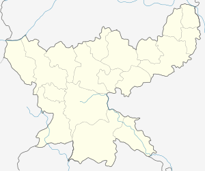  Godda Location in Jharkhand, India | |
| Coordinates: 24°49′42″N 87°12′15″E / 24.82833°N 87.20417°ECoordinates: 24°49′42″N 87°12′15″E / 24.82833°N 87.20417°E | |
| Country |
 India India |
| State | Jharkhand |
| District | Godda |
| Elevation | 145 m (476 ft) |
| Population (2011) | |
| • Total | 221,775 |
| Languages | |
| • Official | Hindi, Santali |
| Literacy (2011) | |
| • Total literates | 108,866 (59.58%) |
| Time zone | IST (UTC+5:30) |
| PIN | 814133 (Godda) |
| Telephone/STD code | 06422 |
| Vehicle registration | JH 17 |
| Lok Sabha constituency | Godda |
| Vidhan Sabha constituency | Godda, Poreyahat |
| Website |
godda |
| CD Block | |
Godda is a community development block that forms an administrative division of Godda district, Jharkhand state, India.
Geography
Godda, the eponymous CD Block headquarters, is located at 24°49′42″N 87°12′15″E / 24.82833°N 87.20417°E.[1]
Godda CD Block has 39 panchayats and 183 villages.[2]
Demographics
As per 2011 Census of India Godda CD Block had a total population of 221,775, of which 216,805 were rural and 4,970 were urban. There were 114,911 (52%) males and 106,864 (48%) females. Population below 6 years was 39,039. Scheduled Castes numbered 20,418 and Scheduled Tribes numbered 28,617.[3]
In 2011 census Sarauni was census town in Godda CD Block with a population of 4,970. There were four large villages (2011 population in brackets): Motiya (4,746), Jamuni Paharpur (6,271), Sarkanda (4,012) and Makhni (4,186).[3]
Literacy
As per 2011 census the total number of literates in Godda CD Block was 108,866 (59.58% of the population over 6 years) out of which 68,028 (62%) were males and 40,838 (38%) were females.[3]
As per 2011 census, literacy in Godda district was 57.40.[4]Literacy in Jharkhand (for population over 7 years) was 66.41% in 2011.[5]Literacy in India in 2011 was 74.04%.[6]
Economy
Agriculture
Agriculture is the major economic activity and around 80% of the population depends on agriculture. However, lack of irrigation facilities is a major constraint in raising the existing low levels of agricultural productivity. A sizable population is also engaged in animal husbandry and cottage industries.[7]
References
- ↑ "Magistrate Colony-Block Campus-Godda". Jharkhand. Wikimapia. Retrieved 24 January 2016.
- ↑ "Godda City". onefivenine. Retrieved 24 January 2016.
- 1 2 3 "2011 Census C.D. Block Wise Primary Census Abstract Data(PCA)". Jharkhand – District-wise CD Blocks. Registrar General and Census Commissioner, India. Retrieved 24 January 2016.
- ↑ "District Census 2011". Population Census 2011. Retrieved 24 January 2016.
- ↑ "Jharkhand Profile" (PDF). Census Info India 2011 – Final population totals. Census Commissioner, Government of India. Retrieved 24 January 2016.
- ↑ "Literacy in India". Census 2011. Census population 2015 data. Retrieved 24 January 2016.
- ↑ "Godda District Official website". Profile. Godda district administration. Retrieved 24 January 2016.