Greny
| Greny | |
|---|---|
  Greny | |
|
Location within Normandy region 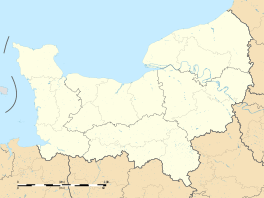 Greny | |
| Coordinates: 49°56′51″N 1°18′25″E / 49.9475°N 1.3069°ECoordinates: 49°56′51″N 1°18′25″E / 49.9475°N 1.3069°E | |
| Country | France |
| Region | Normandy |
| Department | Seine-Maritime |
| Arrondissement | Dieppe |
| Canton | Dieppe-2 |
| Government | |
| • Mayor (2014 - 2020) | Jacques Beauval |
| Area1 | 4.06 km2 (1.57 sq mi) |
| Population (2011)2 | 145 |
| • Density | 36/km2 (92/sq mi) |
| Time zone | CET (UTC+1) |
| • Summer (DST) | CEST (UTC+2) |
| INSEE/Postal code | 76326 / 76630 |
| Elevation |
87–149 m (285–489 ft) (avg. 125 m or 410 ft) |
|
1 French Land Register data, which excludes lakes, ponds, glaciers > 1 km² (0.386 sq mi or 247 acres) and river estuaries. 2 Population without double counting: residents of multiple communes (e.g., students and military personnel) only counted once. | |
Greny is a former commune in the Seine-Maritime department in the Normandy region in northern France. On 1 January 2016, it was merged into the new commune of Petit-Caux.[1]
Geography
A small farming village, Greny is situated in the Pays de Caux, some 9 miles (14 km) east of Dieppe on the D117 road.
Heraldry
 |
The arms of Greny are blazoned : Vert, a chevron argent between 2 garbs and a tree, and on a chief Or a leopard gules. |
Population
| Year | 1962 | 1968 | 1975 | 1982 | 1990 | 1999 | 2006 | 2011 |
|---|---|---|---|---|---|---|---|---|
| Population | 121 | 122 | 124 | 102 | 111 | 105 | 138 | 145 |
| From the year 1962 on: No double counting—residents of multiple communes (e.g. students and military personnel) are counted only once. | ||||||||
Places of interest
- The church of St. Anne, dating from the seventeenth century.
See also
References
- ↑ Arrêté préfectoral 26 November 2015 (French)
External links
 |
Wikimedia Commons has media related to Greny. |
- Greny on the Quid website (French)
This article is issued from Wikipedia - version of the 3/14/2016. The text is available under the Creative Commons Attribution/Share Alike but additional terms may apply for the media files.