Haribomo
| Haribomo | |
|---|---|
| Commune | |
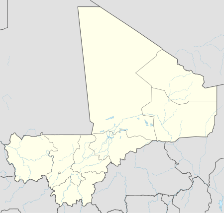  Haribomo Location in Mali | |
| Coordinates: 16°4′30″N 2°40′16″W / 16.07500°N 2.67111°WCoordinates: 16°4′30″N 2°40′16″W / 16.07500°N 2.67111°W | |
| Country |
 Mali Mali |
| Region | Tombouctou Region |
| Cercle | Gourma-Rharous Cercle |
| Area | |
| • Total | 3,500 km2 (1,400 sq mi) |
| Population (2009 census)[1] | |
| • Total | 7,389 |
| • Density | 2.1/km2 (5.5/sq mi) |
| Time zone | GMT (UTC+0) |
Haribomo is a rural commune of the Cercle of Gourma-Rharous in the Tombouctou Region of Mali. The commune contains 29 villages and in the 2009 census had a population of 7,389. The principal village (chef-lieu) is Daka Fifo.[2][3]
References
- ↑ Resultats Provisoires RGPH 2009 (Région de Tombouctou) (PDF) (in French), République de Mali: Institut National de la Statistique.
- ↑ Communes de la Région de Tombouctou (PDF) (in French), Ministère de l’administration territoriale et des collectivités locales, République du Mali.
- ↑ Some documents give Daka Ali (or Daka Aly) as the chef-lieu.
External links
- Plan de Sécurité Alimentaire Commune Rurale de Haribomo 2006-2010 (PDF) (in French), Commissariat à la Sécurité Alimentaire, République du Mali, USAID-Mali, 2006.
- Situation des points d'eau modernes au Mali en 2003: Haribomo (in French), Ministère des Mines, de l'Energie et de l'Eau, République du Mali, 2003.
Capital: Timbuktu | ||
| Diré Cercle |  | |
| Goundam Cercle |
| |
| Gourma-Rharous Cercle | ||
| Niafunké Cercle | ||
| Timbuktu Cercle |
| |
This article is issued from Wikipedia - version of the 3/1/2013. The text is available under the Creative Commons Attribution/Share Alike but additional terms may apply for the media files.