Hinter Grauspitz
| Hinter Grauspitz | |
|---|---|
| Schwarzhorn | |
 Hinter Grauspitz from the south east (Swiss) side. | |
| Highest point | |
| Elevation | 2,574 m (8,445 ft) |
| Prominence | 72 m (236 ft) [1] |
| Parent peak | (Vorder) Grauspitz |
| Coordinates | 47°3′17.4″N 9°35′17.0″E / 47.054833°N 9.588056°ECoordinates: 47°3′17.4″N 9°35′17.0″E / 47.054833°N 9.588056°E |
| Geography | |
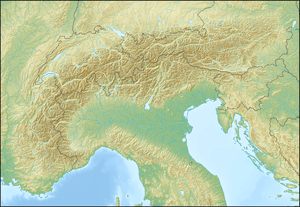  Hinter Grauspitz Location in the Alps | |
| Location |
Triesen, Liechtenstein Graubünden, Switzerland |
| Parent range | Rätikon, Alps |
The Hinter Grauspitz (also known as Schwarzhorn) is a mountain on the border of Switzerland and Liechtenstein in the Rätikon range of the Eastern Alps. With a height of 2,574 metres (8,445 ft) above sea level, it is the second highest summit in Liechtenstein.
References
- Unfolding Liechtenstein, Panorama Map (Map). Liechtenstein Tourismus. 2007.
- Feldkirch - Vaduz (Map). 1:50000. Wander, Bike- und Skitourenkarte. Cartography by Kompass-Karten GmbH. Kompass. 2007.
- Schesaplana (Map). 1:25000. Landeskarte der Schweiz. swisstopo. 2004.
External links
This article is issued from Wikipedia - version of the 1/28/2016. The text is available under the Creative Commons Attribution/Share Alike but additional terms may apply for the media files.