Hubners Bridge
| Hubners Bridge | |
|---|---|
 | |
| Coordinates | 26°51′13″S 152°37′36″E / 26.8537°S 152.626642°ECoordinates: 26°51′13″S 152°37′36″E / 26.8537°S 152.626642°E |
| Carries | Motor vehicles |
| Crosses | Sandy Creek |
| Locale |
Sandy Creek, Queensland,  Australia Australia |
| History | |
| Collapsed | 9 January 2011 |
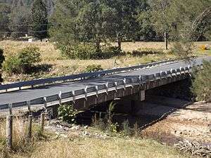
The Hubners Bridge (also known as Hubner Bridge) was a road bridge on the Sandy Creek Road over Sandy Creek in the locality of Sandy Creek, northeast of Kilcoy in South East Queensland, Australia.
The bridge was washed away on 9 January 2011 during the catastrophic 2010–2011 floods.[1] A flying-fox was built across Sandy Creek to provide supplies to residents stranded due to bridge damage.[2] It has been rebuilt since then and was re-opened on 6 April 2012.[3]
References
- ↑ "Supplies "flown" into Mt Kilcoy". Glenn Roberts. northern-times. 14 Jan 2011. Retrieved 18 January 2011.
- ↑ "Recovery picks up as water goes down". Peter Hall. Courier Mail. 18 January 2011. Retrieved 18 January 2011.
- ↑ "Major general opens Hubner's Bridge". Queensland-government. 7 March 2012. Retrieved 5 September 2016.
This article is issued from Wikipedia - version of the 9/6/2016. The text is available under the Creative Commons Attribution/Share Alike but additional terms may apply for the media files.