Indre Sula
This article is about the mountain in Surnadal, Norway. For other uses, see Sula.
| Indre Sula | |
|---|---|
 | |
| Highest point | |
| Elevation | 1,325 m (4,347 ft) |
| Coordinates | 62°51′14″N 08°44′57″E / 62.85389°N 8.74917°ECoordinates: 62°51′14″N 08°44′57″E / 62.85389°N 8.74917°E |
| Geography | |
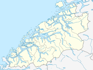  Indre Sula Location in Møre og Romsdal | |
| Location | Surnadal, Møre og Romsdal, Norway |
| Parent range | Trollheimen |
| Topo map | 1420 I Snota |
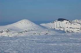
Indre Sula is a mountain in the municipality of Surnadal in Møre og Romsdal county, Norway. It is part of the Trollheimen mountain range, and it lies just north of Todalsøra and the Todalsfjorden.[1]
Indre Sula, meaning "Inner Sula", lies next to Ytre Sula, meaning "Outer Sula". The route from Indre Sula to Ytre Sula is scrambling.
References
- ↑ "Indre Sula" (in Norwegian). yr.no. Retrieved 2010-12-07.
This article is issued from Wikipedia - version of the 5/28/2015. The text is available under the Creative Commons Attribution/Share Alike but additional terms may apply for the media files.