Interstate 15 in Montana
| ||||
|---|---|---|---|---|
_map.svg.png) | ||||
| Route information | ||||
| Maintained by Montana Department of Transportation | ||||
| Length: | 397.50 mi[1] (639.71 km) | |||
| Major junctions | ||||
| South end: |
 I-15 at Idaho state line I-15 at Idaho state line | |||
 I‑90 in Butte I‑90 in Butte I‑115 in Butte I‑115 in Butte US 287 in Helena US 287 in Helena US 89 in Great Falls US 89 in Great Falls US 2 in Shelby US 2 in Shelby | ||||
| North end: |
 Hwy 4 at Canadian border near Sweetgrass Hwy 4 at Canadian border near Sweetgrass | |||
| Highway system | ||||
| ||||
.svg.png)


In the U.S. state of Montana, Interstate 15 continues onward from Idaho for nearly 400 miles (640 km) through the cities of Butte, Helena and Great Falls, intersecting with Interstate 90, Interstate 115 and Interstate 315. Interstate 15 reaches its northern terminus at the international border with Alberta, Canada.
Interstate 15 joins with I-90 and makes a junction with a short, one-mile (1.6 km) spur route Interstate 115 in Butte.
Route description
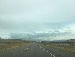
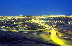
I-15 crosses into Montana from Idaho just south of Lima Reservoir, before the route continues northwest through farmland and desert. The freeway turns north at Clark Canyon Reservoir, before turning northeast. In the town of Dillon, I-15 passes near Clark's Lookout State Park before beginning to parallel the Big Hole River. The freeway then turns away from the river, continuing northeast along Divide Creek through the desert, before splitting away from the creek and heading north. I-15 eventually merges into I-90 at a trumpet interchange.[2]
I-15 and I-90 run concurrently through the city of Butte, coming first to an interchange with I-115, signed as Business Loop 15 and Business Loop 90. I-15 and I-90 pass through a green area in the middle of the city, before I-15 splits off to the northeast on the eastern end of the town. The freeway goes through the forest and plains north of I-90 before winding along Bison Creek and later the Boulder River. I-15 passes through the town of Basin before leaving the mountains and providing access to Boulder. Paralleling Beavertown Creek, the road winds through the hills before passing through Jefferson City. The freeway continues into Helena, where I-15 intersects US 12 and runs concurrently with US 287 through the outskirts of the city before continuing north through the plains.[2]
I-15 and US 287 continue along Little Prickly Pear Creek before passing through the town of Wolf Creek after several miles. Northeast of there, US 287 continues north, while I-15 runs close to the Missouri River. The freeway provides access to Cascade and then continues through the plains through Ulm before turning northeast into the city of Great Falls. I-315 and US 89 intersect with I-15 at a trumpet interchange, and US 89 continues north and then northwest along I-15 for a few miles before continuing to the west. I-15 continues northwest through farmland before passing near Dutton and Brady, and the city of Conrad. US 2 intersects I-15 in the town of Shelby. The freeway passes through the town of Sunburst, then passes through a final stretch of farmland. Eventually, Interstate 15 passes through the last town before Canada, Sweet Grass, and then crosses the international border, becoming Alberta Highway 4.
From Helena to Sweetgrass at the Canadian border, Interstate 15 is dedicated as a memorial highway to the First Special Service Force.
Exit list
| County | Location[3] | mi[3] | km | Exit | Destinations | Notes |
|---|---|---|---|---|---|---|
| Monida Pass | 0.000 | 0.000 | I-15 continues south towards Idaho Falls | |||
| 0.509 | 0.819 | 0 |  S-509 – Monida S-509 – Monida | |||
| Beaverhead | | 9.544 | 15.360 | 9 | Snowline (ranch access) | |
| Lima | 15.185 | 24.438 | 15 | Lima | ||
| Dell | 23.832 | 38.354 | 23 | Dell | ||
| | 29.609 | 47.651 | 29 | Kidd | ||
| | 37.353 | 60.114 | 37 | Red Rock | ||
| | 44.454 | 71.542 | 44 |  S-324 west – Clark Canyon Reservoir S-324 west – Clark Canyon Reservoir | ||
| | 51.199 | 82.397 | 51 | Dalys | Southbound exit and northbound entrance only | |
| | 52.613 | 84.672 | 52 | Grasshopper Creek | ||
| | 56.028 | 90.168 | 56 | Barretts | ||
| | 59.702 | 96.081 | 59 |   S-278 west / S-222 – Jackson, Wisdom S-278 west / S-222 – Jackson, Wisdom | ||
| Dillon | 62.440 | 100.487 | 62 |  I‑15 Bus. north – Dillon I‑15 Bus. north – Dillon | ||
| 63.813 | 102.697 | 63 |  I‑15 Bus. south / MT 41 – Dillon I‑15 Bus. south / MT 41 – Dillon | |||
| | 75.046 | 120.775 | 74 | Apex, Birch Creek | ||
| | 85.272 | 137.232 | 85 | Glen | ||
| Madison | Melrose | 93.188 | 149.972 | 93 | Melrose | |
| Silver Bow | | 99.266 | 159.753 | 99 | Moose Creek Road | |
| | 102.515 | 164.982 | 102 |  MT 43 west – Wisdom MT 43 west – Wisdom | ||
| | 111.271 | 179.073 | 111 | Feely | ||
| | 116.361 | 187.265 | 116 | Buxton | ||
| | 119.970 | 193.073 | 119 | Hub Access – Silver Bow | ||
| | 121.462 | 195.474 | 121 | I‑90 west – Missoula | South end of I-90 overlap; I-90 east exit 219; left exits; left entrance northbound | |
| | 122.491 | 197.130 | 122 | Rocker | ||
| Butte | 124.319 | 200.072 | 124 |  I‑115 east / I‑15 Bus. north / I‑90 Bus. east – City Center I‑115 east / I‑15 Bus. north / I‑90 Bus. east – City Center | Northbound exit and southbound entrance | |
| 126.343 | 203.329 | 126 | Montana Street | |||
| 127.961 | 205.933 | 127 | I‑15 Bus. south / I‑90 Bus. west (Harrison Avenue) | Signed as exits 127A and 127B northbound; I-15 Bus./I-90 Bus. not signed northbound | ||
| 129.498 | 208.407 | 129 | I‑90 east – Billings | North end of I-90 overlap; I-90 west exit 227; left exits; left entrance southbound | ||
| Jefferson | | 134.061 | 215.750 | 134 | Woodville | |
| | 138.698 | 223.213 | 138 | Elk Park | ||
| | 151.226 | 243.375 | 151 | Bernice | ||
| | 156.391 | 251.687 | 156 | Basin | ||
| | 159.831 | 257.223 | 160 | High Ore Road | ||
| | 164.406 | 264.586 | 164 |  MT 69 – Boulder MT 69 – Boulder | ||
| | 175.576 | 282.562 | 176 | Jefferson City | ||
| | 181.575 | 292.217 | 182 | Clancy | ||
| | 187.161 | 301.206 | 187 |  S-518 (Sec-282) – Montana City S-518 (Sec-282) – Montana City | ||
| Lewis and Clark | Helena | 189.986 | 305.753 | 190 | South Helena, Nob Hill area | |
| 191.602 | 308.354 | 192 |  I‑15 Bus. north / US 12 / US 287 south – Townsend, Capitol Area I‑15 Bus. north / US 12 / US 287 south – Townsend, Capitol Area | South end of US 287 overlap | ||
| 192.772 | 310.236 | 193 | I‑15 Bus. south (Cedar Street) | |||
| 199.535 | 321.120 | 200 |   S-279 / S-453 (Lincoln Road) S-279 / S-453 (Lincoln Road) | |||
| | 208.573 | 335.666 | 209 | Gates of the Mountains | ||
| | 215.440 | 346.717 | 216 | Sieben | ||
| | 218.667 | 351.910 | 219 | Spring Creek | Northbound exit and southbound entrance | |
| | 226.223 | 364.071 | 226 |  S-434 – Wolf Creek S-434 – Wolf Creek | ||
| | 228.022 | 366.966 | 228 | US 287 north – Augusta, Choteau | North end of US 287 overlap | |
| | 233.698 | 376.100 | 234 | Craig | ||
| Cascade | | 239.817 | 385.948 | 240 | Dearborn | |
| | 243.533 | 391.928 | 244 | Canyon Access | ||
| | 246.807 | 397.197 | 247 | Hardy Creek | ||
| | 249.531 | 401.581 | 250 | Local Access | ||
| | 254.042 | 408.841 | 254 |  MT 68 – Cascade MT 68 – Cascade | ||
| | 255.555 | 411.276 | 256 | MT 68 – Cascade | ||
| | 269.495 | 433.710 | 270 |  S-330 – Ulm S-330 – Ulm | ||
| Great Falls | 276.889 | 445.610 | 277 | Great Falls International Airport | ||
| 278.063 | 447.499 | 278 |  I‑15 Bus. north / US 89 south / MT 200 east (10th Avenue South, I-315 east, MT 3 south) I‑15 Bus. north / US 89 south / MT 200 east (10th Avenue South, I-315 east, MT 3 south) | South end of US 89/MT 200 overlap | ||
| 279.652 | 450.056 | 280 |  I‑15 Bus. south to US 87 north (Central Avenue West) I‑15 Bus. south to US 87 north (Central Avenue West) | |||
| 281.631 | 453.241 | 282 | To US 87 north / Northwest Bypass | Southbound exit and northbound entrance | ||
| | 285.509 | 459.482 | 286 | Manchester | ||
| | 289.607 | 466.077 | 290 | US 89 north / MT 200 west – Missoula, Choteau | North end of US 89/MT 200 overlap | |
| | 296.752 | 477.576 | 297 | Gordon | ||
| Teton | | 301.528 | 485.262 | 302 |  S-431 – Power S-431 – Power | |
| | 311.672 | 501.587 | 313 |   S-221 / S-379 – Dutton, Choteau S-221 / S-379 – Dutton, Choteau | ||
| | 319.467 | 514.132 | 321 | Collins Road | ||
| Pondera | | 326.128 | 524.852 | 328 |  S-365 – Brady S-365 – Brady | |
| | 333.507 | 536.727 | 335 | I‑15 Bus. north (Midway Road) – Conrad | ||
| Conrad | 337.358 | 542.925 | 339 | I‑15 Bus. south – Conrad | ||
| | 343.245 | 552.399 | 345 |  S-366 (Ledger Road) – Tiber Dam S-366 (Ledger Road) – Tiber Dam | ||
| | 346.250 | 557.235 | 348 |  MT 44 (Valier Road) MT 44 (Valier Road) | ||
| | 350.259 | 563.687 | 352 | Bullhead Road | ||
| Toole | | 356.788 | 574.195 | 358 | Golf Course Road, Marias Valley Road | |
| Shelby | 361.350 | 581.536 | 363 | I‑15 Bus. north / US 2 – Shelby, Cut Bank | ||
| | 362.601 | 583.550 | 364 | I‑15 Bus. south – Shelby | ||
| | 367.118 | 590.819 | 369 | Bronken Road | ||
| | 371.114 | 597.250 | 373 | Potter Road | ||
| | 377.123 | 606.921 | 379 |   S-215 / S-343 – Kevin, Oilmont S-215 / S-343 – Kevin, Oilmont | ||
| | 383.128 | 616.585 | 385 | Swayze Road | ||
| Sunburst | 387.677 | 623.906 | 389 |  S-552 – Sunburst S-552 – Sunburst | ||
| | 391.930 | 630.750 | 394 | Ranch Access | ||
| | 395.770 | 636.930 | 397 | Sweetgrass (S-214) | ||
| | 396.030 | 637.349 | Canadian border Roadway continues north as Hwy 4 | |||
1.000 mi = 1.609 km; 1.000 km = 0.621 mi
| ||||||
References
- ↑ "Route Log- Main Routes of the Eisenhower National System of Interstate and Defense Highways - Table 1". Retrieved 4 October 2014.
- 1 2 Google (December 22, 2013). "Interstate 15 in Montana" (Map). Google Maps. Google. Retrieved December 22, 2013.
- 1 2 Staff (2011). Montana Road Log (PDF) (Report). Montana Department of Transportation. p. 2-8. Retrieved December 21, 2013.
External links
| Interstate 15 | ||
|---|---|---|
| Previous state: Idaho |
Montana | Next state: Terminus |