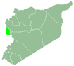
Kaff al-Hammam
Kaff al-Hammam (Arabic: كاف الحمام, also spelled Kaf al-Hamam) is a village and suburb in northwestern Syria, administratively part of the Tartus Governorate, located southeast of Tartus. Nearby localities include Hammam Wasel to the northwest, al-Qadmus to the northeast, Hammam Qanyah and al-Riqama to the east, Brummanet al-Mashayekh to the southeast, al-Shaykh Badr to the south, Brummanet Raad to the southwest and al-Qamsiyah to the west. According to the Syria Central Bureau of Statistics, Kaff al-Hammam had a population of 372 in the 2004 census.[1] The inhabitants of the village are predominantly Ismailis.[2]
References
|
|---|
|
|
|
| |
|
|
|
|
|
| |
|---|
|
- Duraykish
- al-Baqaa
- Dweir Ruslan
- Junaynet Ruslan
- Fajlit
- Hamin
|
|
|
|

 Syria
Syria