Kamiyama, Tokushima
| Kamiyama 神山町 | ||
|---|---|---|
| Town | ||
|
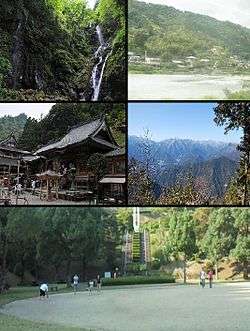
Clockwise from upper left: Amagoi Fall, Akui River, view of Mount Tsurugi from Shōsan Temple, square in Kamiyama Forest Park, Shōsan Temple | ||
| ||
 Location of Kamiyama in Tokushima Prefecture | ||
  Kamiyama Location in Japan | ||
| Coordinates: 33°58′N 134°21′E / 33.967°N 134.350°ECoordinates: 33°58′N 134°21′E / 33.967°N 134.350°E | ||
| Country | Japan | |
| Region | Shikoku | |
| Prefecture | Tokushima Prefecture | |
| District | Myōzai | |
| Government | ||
| • Mayor | Masakazu Goto (since June 2005) | |
| Area | ||
| • Total | 173.31 km2 (66.92 sq mi) | |
| Population (May 1, 2012) | ||
| • Total | 6,325 | |
| • Density | 36.50/km2 (94.5/sq mi) | |
| Symbols | ||
| • Tree | Cryptomeria | |
| • Flower | Prunus mume | |
| • Bird | Copper pheasant | |
| Time zone | Japan Standard Time (UTC+9) | |
| City hall address |
100 Jinjyō-ji Honnoma, Kamiyama-chō, Myōzai-gun, Tokushima-ken 771-3395 | |
| Website |
www | |

Kamiyama (神山町 Kamiyama-chō) is a town in Myōzai District, Tokushima Prefecture, Japan.
As of May 1, 2012, the town has an estimated population of 6,325, with 2,574 households, and a density of 36.50 people per km2. The total area is 173.31 km2.[1]
The area has been settled since ancient times and is mentioned in the Nihon Shoki.[1] Notable sights include the Amagoi Waterfalls, regularly listed among the 100 most beautiful waterfalls of Japan, plum orchards, Shosan-ji Temple, one of the 88 sites on the Shikoku pilgrimage route, and a 500-year-old Ginkgo tree, which is especially beautiful during the fall.[1]
Sights
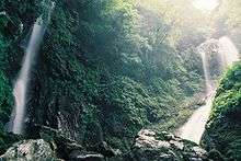
- Amagoi Waterfalls
- Shosan-ji Temple
- Okubo Chichi-Icho Ginkgo tree
Notes
- 1 2 3 "Kamiyama Information". Kamiyama-cho office. Retrieved 20 November 2014.
External links
 |
Wikimedia Commons has media related to Kamiyama, Tokushima. |
- Official website (in Japanese)
- Official website (in English)
This article is issued from Wikipedia - version of the 3/3/2016. The text is available under the Creative Commons Attribution/Share Alike but additional terms may apply for the media files.