Keel Creek Bridge
|
Keel Creek Bridge | |
   | |
| Nearest city | Coalgate, Oklahoma |
|---|---|
| Coordinates | 34°36′34″N 96°8′42″W / 34.60944°N 96.14500°WCoordinates: 34°36′34″N 96°8′42″W / 34.60944°N 96.14500°W |
| Area | less than one acre |
| Built | 1940 |
| Architectural style | concrete slab bridge |
| NRHP Reference # | 07000257[1] |
| Added to NRHP | April 4, 2007 |
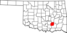
The Keel Creek Bridge is a bridge on Oklahoma State Highway 31 seven miles northeast of Coalgate, Oklahoma.[2] The bridge is listed on the National Register of Historic Places.[3] It was constructed as a Works Progress Administration project. The bridge is significant because of its importance to the transportation history of the area and because it is a WPA-built structure.[2]
History
Prior to the Great Depression, the economy of Coal County, Oklahoma was already very poor; the county's main product, coal, was no longer in demand by railroads, which had switched to oil-powered trains, and boll weevils had decimated the county's cotton farms.[2][4] The railroads abandoned the lines to Coal County since coal was no longer needed.[2] The Great Depression further weakened the county economy.[2] A variety of New Deal projects were completed in Coal County, which provided needed employment and improved the quality of life.[2] Coal County had historically had very poor roads, and the end of railroad transport in Coal County meant that roads were an essential means of transportation.[2] Coal County thus prioritized infrastructure improvements, ranging from road resurfacing to bridge construction.[2] Between 10 and 15 bridges were built in Coal County, including the Keel Creek Bridge.[2] The Keel Creek Bridge was completed in 1940 as a Farm-to-market road project.[2] In 2007, when it was nominated for the National Register of Historic Places, it was still in use, even though many of the WPA bridges in Coal County had been replaced.[2]
Architecture
The bridge is a concrete slab bridge with a sandstone foundation.[2] Stone was chosen because it would require the greatest number of workers.[2] The poured concrete slab deck was chosen because it met Oklahoma highway department of transportation standards for strength and width.[2] The bridge has three spans with two piers and, the bridge deck is around 18 feet above Keel Creek.[2] The masonry shows that those who worked on the bridge were either skilled stonemasons or had perhaps developed their skills working on previous bridge projects.[2] The stones were cut with sharp edges, which gives the bridge a finer appearance than the other Coal County bridges.[2] The bridge has extruded mortar joints, which is a feature no other Coal County WPA structure has.[2]
References
- ↑ National Park Service (2010-07-09). "National Register Information System". National Register of Historic Places. National Park Service.
- 1 2 3 4 5 6 7 8 9 10 11 12 13 14 15 16 17 18 author unknown (February 3, 2007). "National Register of Historic Places Inventory/Nomination: Keel Creek Bridge" (pdf). National Park Service. "Accompanying 5 photos, by Jim Gabbert, year 2006." (pdf). National Register of Historic Places Inventory.
- ↑ State Historic Preservation Office: Oklahoma Historical Society.Oklahoma's National Register Handbook. April 1, 2015. Accessed July 2, 2015.
- ↑ Milligan, James C. "Coal County," Encyclopedia of Oklahoma History and Culture, 2009. Accessed March 28, 2015.