Keetmanshoop Airport
| Keetmanshoop Airport | |||||||||||||||
|---|---|---|---|---|---|---|---|---|---|---|---|---|---|---|---|
| IATA: KMP – ICAO: FYKT | |||||||||||||||
| Summary | |||||||||||||||
| Airport type | Public | ||||||||||||||
| Owner/Operator | Namibia Airports Co.[1] | ||||||||||||||
| Serves | Keetmanshoop, Namibia | ||||||||||||||
| Elevation AMSL | 3,506 ft / 1,069 m | ||||||||||||||
| Coordinates | 26°32′15″S 18°06′40″E / 26.53750°S 18.11111°E | ||||||||||||||
| Map | |||||||||||||||
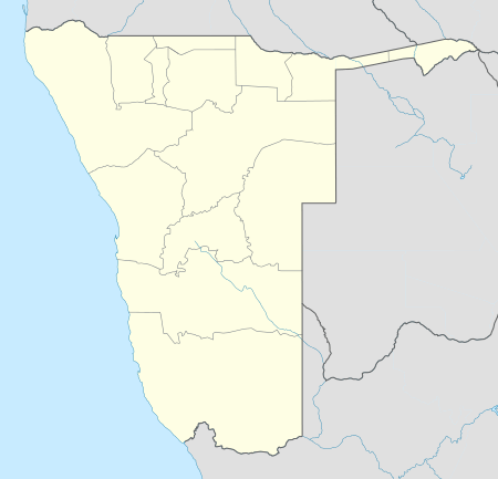  Keetmanshoop Location of airport in Namibia | |||||||||||||||
| Runways | |||||||||||||||
| |||||||||||||||
Keetmanshoop Airport (IATA: KMP, ICAO: FYKT) is an airport serving Keetmanshoop, a city in the ǁKaras Region of Namibia. The airport is located about 5 km (3 mi) northwest of the town.[5] It has customs and immigration services and is home to the Namibia Aviation Training Academy (NATA).[2]
The Keetmanshoop VOR-DME (Ident: KTV) is on the field. The Keetmanshoop non-directional beacon (Ident: KT) is located 1.0 nautical mile (1.9 km) off the threshold of Rwy 04.[6][7]
See also
 Aviation portal
 Namibia portal
- List of airports in Namibia
- Transport in Namibia
References
- ↑ Namibia Airports Company: Airport Information at WebCite (archived 2013-01-24)
- 1 2 "Keetmanshoop Airport". Namibia Airports Company, Ltd. Retrieved 18 Feb 2010.
- ↑ Airport information for FYKT from DAFIF (effective October 2006)
- ↑ Airport information for KMP at Great Circle Mapper.
- ↑ "Distance from Keetmanshoop to airport". WikiMapia. Retrieved 18 Feb 2010.
- ↑ KT NDB
- ↑ KTV VOR-DME
External links
This article is issued from Wikipedia - version of the 11/27/2016. The text is available under the Creative Commons Attribution/Share Alike but additional terms may apply for the media files.