Kisei Expressway
| |
|---|---|
| 紀勢自動車道 | |
| Route information | |
| Length: | 94.6 km[1] (58.8 mi) |
| Existed: | 2006[2] – present |
| Major junctions | |
| From: |
Seiwa-Taki Junction in Taki, Mie Ise Expressway Ise Expressway |
| To: |
Nanki-Tanabe Interchange in Tanabe, Wakayama Hanwa Expressway |
| Highway system | |
|
National highways of Japan Expressways of Japan | |
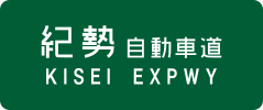
The Kisei Expressway (紀勢自動車道 Kisei Jidōshadō) is a national expressway in Japan. It is owned and operated by Central Nippon Expressway Company.
Naming
The name Kisei (紀勢) is a kanji acronym consisting of characters found in the former names of the provinces linked by the expressway. Kii Province (紀伊) consists of the eastern part of present-day Wakayama Prefecture, and Ise Province (伊勢) consists of present-day Mie Prefecture.
The expressway is officially designated as the Hanwa Expressway Kisei Route, however this designation does not appear on any signage.[3]
Overview
The first section of the expressway was opened in 2006 (from the origin to Ōmiya-Ōdai Interchange). Another section (to Kisei-Ouchiyama Interchange) opened in 2009 and the next section (to Kii-Nagashima Interchange) opened in 2013.[4] The expressway beyond this point is still in the planning stages and will be built according to the New Direct Control System.[5] Under this system, the financial burden for planning and building expressways will be shared by both the national and local governments; this differs from the established system which is carried out exclusively by the national government. Expressways built under this system are also planned to be toll-free.
The route is 2 lanes for its entire length, with some overtaking areas. The speed limit is 70 km/h.
List of interchanges and features

- (IC - interchange, JCT - junction, PA - parking area, TB - toll gate, TN - tunnel, BR - bridge
Between Seiwa-Taki Junction and Owase-minami Interchange
| No. | Name | Connections | Dist. from Origin |
Dist. from Terminus |
Notes | Location (all in Mie) | ||
|---|---|---|---|---|---|---|---|---|
| (39-1) | Seiwa-Taki JCT | Ise Expressway |
0.0 | 55.3 | Taki | |||
| (39) | Seiwa-Taki IC |  National Route 42 National Route 42 | ||||||
| TN | Shikifuto Tunnel | ↓ | ↑ | Length - 414 m | ||||
| TN | Kaminose Tunnel | ↓ | ↑ | Length - 704 m | ||||
| PA | Okuise PA | ↓ | ↑ | Ōdai | ||||
| TN | Mise Tunnel | ↓ | ↑ | Length - 593 m | ||||
| BR | Kisei-Miyagawa Bridge | ↓ | ↑ | Length - 537 m | ||||
| Taiki | ||||||||
| TN | Funaki Tunnel | ↓ | ↑ | Length - 1,059 m | ||||
| 1 | Ōmiya-Ōdai IC | National Route 42 |
13.4 | 41.9 | Ōdai | |||
| 2 | Kisei-Ouchiyama IC | Pref. Route 68 (Kisei Inter Route) | 23.8 | 31.5 | Taiki | |||
| TB | Taki Toll Gate | |||||||
| 3 | Kii-Nagashima IC |  National Route 422 National Route 422 |
34.1 | 21.2 | Kihoku | |||
| PA | Kihoku PA | 41.8 | 13.5 | |||||
| 4 | Miyama IC | National Route 42 |
49.2 | 6.1 | New Direct Control System | |||
| 5 | Owase-kita IC |  National Route 425 National Route 425 |
55.3 | 0.0 | New Direct Control System | Owase | ||
| This section in planning stages | ||||||||
| <6> | Owase-minami IC | Connects to Kumano Owase Road | ||||||
| This section in planning stages | ||||||||
| Through to Hanwa Expressway | ||||||||
Between Nanki-Tanabe and Susami-minami Interchanges
| No. | Name | Connections | Dist. from Origin |
Dist. from Terminus |
Notes | Location (all in Wakayama) |
|---|---|---|---|---|---|---|
| Through to Hanwa Expressway | ||||||
| 34 | Nanki-Tanabe IC | National Route 42 (Tanabe Nishi Bypass) |
0.0 | 39.3 | Tanabe | |
| Emergency Exit | ↓ | ↑ | Access for Kinan Hospital Authorized vehicles only | |||
| 35 | Kamitonda IC | National Route 42 |
7.9 | 31.4 | Kamitonda | |
| Michinoeki Kuchikumano | ↓ | ↑ | Northbound only | |||
| 36 | Nanki-Shirahama IC | National Route 42 |
14.4 | 24.9 | Shirahama | |
| 37 | Hikigawa IC | 23.7 | 15.6 | |||
| 38 | Susami IC | 29.9 | 9.4 | Susami | ||
| 39 | Susami-minami IC | Susami Kushimoto Road |
39.3 | 0.0 | ||
| This section in planning stages | ||||||
References
- ↑ "Table of Tolls" (PDF). Retrieved 2013-02-19.
- ↑ "C-NEXCO Press Release". Retrieved 2008-04-17.
- ↑ Ministry of Land, Infrastructure and Transport. "High Standard Trunk Road Map" (pdf). Retrieved 2008-04-13.
- ↑ "C-NEXCO Press Release About Kisei Expressway". Retrieved 2013-02-19.
- ↑ "Kisei Expressway Construction Site Information". Retrieved 2008-04-17.
External links
| East Nippon Expressway Company | |
|---|---|
| Central Nippon Expressway Company | |
| West Nippon Expressway Company |
|
| Honshū-Shikoku Bridge Expressway Company |
|
| Urban Expressways | |