Koetong
| Koetong Victoria | |
|---|---|
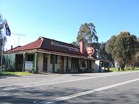 The Koetong Pub on the Murray Valley Highway | |
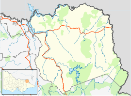  Koetong Location in Shire of Towong, Victoria | |
| Coordinates | 36°09′S 147°30′E / 36.150°S 147.500°ECoordinates: 36°09′S 147°30′E / 36.150°S 147.500°E |
| Postcode(s) | 3704 |
| Location |
|
| LGA(s) | Shire of Towong |
| State electorate(s) | Benambra |
| Federal Division(s) | Indi |
Koetong is a locality in north-east Victoria, Australia. The locality, part of the Towong Shire local government area, is on the Murray Valley Highway between Tallangatta and Corryong, 394 kilometres (245 mi) north-east of the state capital, Melbourne, .
Koetong was surveyed in 1885 but not proclaimed until 1952.[1] Tin and gold mining has been sporadically carried out in the area since 1873.[2]
The local state school first opened in 1890 and after several temporary closures, closed permanently in 2003.[1] The town is an access point to nearby Mount Lawson State Park.[3]
References
See also
This article is issued from Wikipedia - version of the 8/22/2013. The text is available under the Creative Commons Attribution/Share Alike but additional terms may apply for the media files.