Kouandé
| Kouandé | |
|---|---|
| Commune, arrondissement and town | |
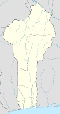  Kouandé Location in Benin | |
| Coordinates: 10°19′54″N 1°41′29″E / 10.33167°N 1.69139°ECoordinates: 10°19′54″N 1°41′29″E / 10.33167°N 1.69139°E | |
| Country |
 Benin Benin |
| Department | Atakora Department |
| Area | |
| • Total | 4,500 km2 (1,700 sq mi) |
| Elevation | 436 m (1,430 ft) |
| Population (2013 census) | |
| • Total | 112,014 |
| • Density | 25/km2 (64/sq mi) |
| Time zone | WAT (UTC+1) |
Kouandé is a town, arrondissement and commune, located in the Atakora Department of Benin.The commune covers an area of 4500 square kilometres and as of 20013 had a population of 112,014 people.[1][2] The main town had an estimated 7,127 people in 2008.
References
- ↑ "Kouande". Atlas Monographique des Communes du Benin. Retrieved January 5, 2010.
- ↑ "Communes of Benin". Statoids. Retrieved January 5, 2010.
This article is issued from Wikipedia - version of the 12/21/2013. The text is available under the Creative Commons Attribution/Share Alike but additional terms may apply for the media files.