Kreuttal
| Kreuttal | ||
|---|---|---|
| ||
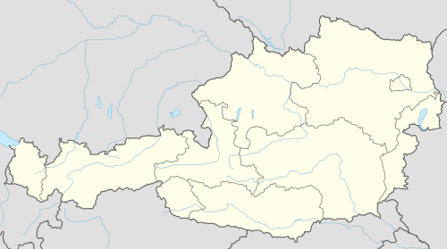  Kreuttal Location within Austria | ||
| Coordinates: 48°26′N 16°29′E / 48.433°N 16.483°ECoordinates: 48°26′N 16°29′E / 48.433°N 16.483°E | ||
| Country | Austria | |
| State | Lower Austria | |
| District | Mistelbach | |
| Government | ||
| • Mayor | Markus Koller (ÖVP) | |
| Area | ||
| • Total | 21.48 km2 (8.29 sq mi) | |
| Elevation | 207 m (679 ft) | |
| Population (1 January 2016)[1] | ||
| • Total | 1,421 | |
| • Density | 66/km2 (170/sq mi) | |
| Time zone | CET (UTC+1) | |
| • Summer (DST) | CEST (UTC+2) | |
| Postal code | 2123 | |
| Area code | 02245 | |
| Website | www.kreuttal.at | |

Kreuttal is a town in the district of Mistelbach in the Austrian state of Lower Austria.
The town is split into 4 localities (Ortschaft) (number of inhabitants in parentheses, October 2011):[2] Hautzendorf (540), Hornsburg (183), Ritzendorf (25) and Unterolberndorf (673). The town council has 19 members and is made up of ÖVP (12), SPÖ (4) and the Austrian Green Party (3).
Population
| Historical population | ||
|---|---|---|
| Year | Pop. | ±% |
| 1971 | 1,084 | — |
| 1981 | 1,069 | −1.4% |
| 1991 | 1,317 | +23.2% |
| 2001 | 1,308 | −0.7% |
References
- ↑ Statistik Austria - Bevölkerung zu Jahresbeginn 2002-2016 nach Gemeinden (Gebietsstand 1.1.2016) for Kreuttal.
- ↑ "Statistic Austria" (PDF). Retrieved July 10, 2015.
This article is issued from Wikipedia - version of the 8/10/2015. The text is available under the Creative Commons Attribution/Share Alike but additional terms may apply for the media files.