Kuttolsheim
| Kuttolsheim Kíttelse | |
|---|---|
|
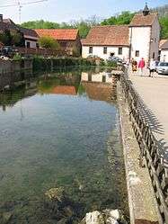
Sainte-Barbe chapel and Schwefelsee | |
  Kuttolsheim | |
|
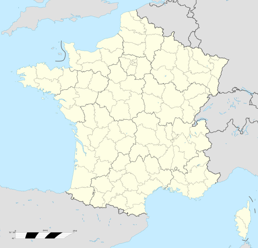
Location within Grand Est region  Kuttolsheim | |
| Coordinates: 48°38′38″N 7°31′30″E / 48.6439°N 7.525°ECoordinates: 48°38′38″N 7°31′30″E / 48.6439°N 7.525°E | |
| Country | France |
| Region | Grand Est |
| Department | Bas-Rhin |
| Arrondissement | Saverne |
| Canton | Bouxwiller |
| Government | |
| • Mayor (2008–2014) | Etienne Burger |
| Area1 | 4.59 km2 (1.77 sq mi) |
| Population (2006)2 | 660 |
| • Density | 140/km2 (370/sq mi) |
| Time zone | CET (UTC+1) |
| • Summer (DST) | CEST (UTC+2) |
| INSEE/Postal code | 67253 / 67520 |
| Elevation | 166–365 m (545–1,198 ft) |
|
1 French Land Register data, which excludes lakes, ponds, glaciers > 1 km² (0.386 sq mi or 247 acres) and river estuaries. 2 Population without double counting: residents of multiple communes (e.g., students and military personnel) only counted once. | |
Kuttolsheim (German: Küttolsheim) is a commune in the Bas-Rhin department in Grand Est in north-eastern France.
It has been built along an old Roman road leading from Strasbourg to Saverne.
Geography
Saverne is approximately twelve kilometres (seven kilometres) to the north-west while Strasbourg is approximately twenty-five kilometres (fifteen miles) to the east. The twentieth century route nationale connecting the two avoids Kuttolsheim but passes through Marlenheim, a short distance to the south.
Landmarks
- Sainte-Barbe chapel: classified as a historic monument; the tower has been built in the 13th century near a sultry spring, probably on the place of an elder sanctuary. The nave dates from the seventeenth century.
- Schwefelsee (sulfur lake): known since the Roman era, its water was then piped to Strasbourg. The lake is a small natural water retain at the outlet of the Souffel's spring. The spring's rate of flow reaches 17 litres per second, its temperature is constant (about 12-13 °C) and therefore the lake never freezes. The sulfur content of the water allowed it to be used since the Roman era until the 1950s in thermae : its curative properties were mostly used to cure skin diseases. The lake also served as a horse bath (als: Rosschwemm) : a mild slope allows them to quietly go into water.
- Saint-Jacques-le-majeur church: the choir tower, built by the architect Bernach in the 12th century, is classified as a historic monument. The present choir and nave have been rebuilt in 1865 after a fire.
- Buddhist temple: Since 1978, Kuttolsheim is one of the four places in Alsace where a Buddhist centre can be found. Since it is the European Institute of Tibetan Buddhism, the Dalai Lama went there many times.[1]
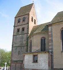
Saint-Jacques-le-majeur church
See also
References
- ↑ Photos can be seen on the official site of the Institute (in english).
External links
 |
Wikimedia Commons has media related to Kuttolsheim. |

This article is issued from Wikipedia - version of the 11/13/2016. The text is available under the Creative Commons Attribution/Share Alike but additional terms may apply for the media files.