Lake Rotopounamu
| Lake Rotopounamu | |
|---|---|
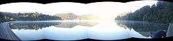 Lake Rotopounamu early on a spring morning | |
| Location | Tongariro National Park, North Island |
| Coordinates | 39°01′36″S 175°44′18″E / 39.0267°S 175.7382°ECoordinates: 39°01′36″S 175°44′18″E / 39.0267°S 175.7382°E |
| Type | landslide formation |
| Primary inflows | seven streams |
| Primary outflows | Nothing visible but has a gurgler |
| Basin countries | New Zealand |
| Surface area | 1 km2 (0.39 sq mi) |
| Max. depth | 9 m (30 ft) |
Lake Rotopounamu is a secluded lake in the Pihanga Scenic Reserve, in the Tongariro National Park in New Zealand's Central North Island.[1] It lies at the northwest foot of Mt Pihanga, and was formed by a landslide around 10,000 years ago.[2] The lake is fed by seven streams, but has no visible surface outflow. It is believed to drain underground.[2]
Recreation
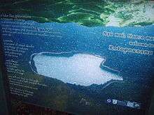
Around the lake is a scenic 5-kilometre (3 mi) loop track, which can be accessed from the Pihanga Saddle road (State Highway 47) between Turangi and Tongariro. Walking this track takes about two hours.
References
- ↑ "Place Name Detail: Lake Rotopounamu". New Zealand Geographic Placenames Database. Land Information New Zealand. Retrieved 2009-03-18.
- 1 2 Rotopounamu track. Department of Conservation.
This article is issued from Wikipedia - version of the 10/28/2015. The text is available under the Creative Commons Attribution/Share Alike but additional terms may apply for the media files.