Lasseter Highway
| Lasseter Highway Northern Territory | |
|---|---|
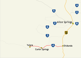 | |
| Map of central Australia with Lasseter Highway highlighted in red | |
| General information | |
| Type | Highway |
| Length | 244 km (152 mi) |
| Route number(s) |
 State Route 4 State Route 4 |
| Major junctions | |
| West end | Tjukaruru Road, Uluru-Katatjuta National Park |
| |
| East end |
 Stuart Highway (National Highway 87), Erldunda Stuart Highway (National Highway 87), Erldunda |
| Location(s) | |
| Major settlements | Yulara, Curtin Springs, Mount Ebenezer |
| Highway system | |
|
Highways in Australia National Highway • Freeways in Australia Highways in the Northern Territory | |
| |

Lasseter Highway is a fully sealed 244 kilometre highway in the Northern Territory of Australia.[1] It connects Yulara, Kata Tjuta and Uluru east to the Stuart Highway.[2] The highway is named after Lewis Hubert (Harold Bell) Lasseter, who claimed to have discovered a fabulously rich gold reef (Lasseter's Reef) west of Kata Tjuta.[3]
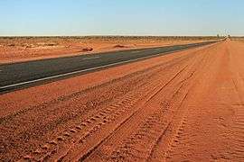 Looking east along the Lasseter Highway toward Erldunda
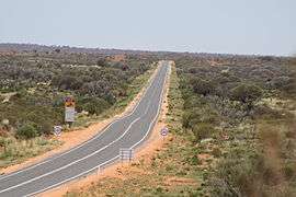 Lasseter Highway at Mount Conner Lookout near Lake Amadeus, March 2010
See also
 Australian Roads portal
References
- ↑ Hema, Maps (2007). Australia Road and 4WD Atlas (Map). Eight Mile Plains Queensland: Hema Maps. pp. 100–101. ISBN 978-1-86500-456-3.
- ↑ Department of Transport (April 1998). "Map of all NT Roads" (PDF). Northern Territory Government. Archived (PDF) from the original on 5 May 2013. Retrieved 13 January 2014.
- ↑ Brooks, Sally (2 September 2011). "Photo essay" (PDF). Centralian Advocate. p. 7. Archived (PDF) from the original on 3 June 2014. Retrieved 3 June 2014.
Road infrastructure in Northern Territory | ||
|---|---|---|
| National highways |  | |
| Highways | ||
| Major urban roads | ||
| Outback tracks and numbered state routes | ||
This article is issued from Wikipedia - version of the 9/5/2016. The text is available under the Creative Commons Attribution/Share Alike but additional terms may apply for the media files.