Life zones of Peru
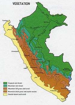
When the Spanish arrived, they divided Peru (very simplistically) into three main regions: the coastal region (11.6% of Peru), that is bounded by the Pacific Ocean; the highlands (28.1% of Peru), that is located on the Andean Heights, and the jungle, that is located on the Amazonian Jungle (Climate of Peru). But Javier Pulgar Vidal (es), a geographer who studied the biogeographic reality of the Peruvian territory for a long time, proposed the creation of eight Natural Regions.[1][2] In 1941, he presented his thesis "Las Ocho Regiones Naturales del Perú" at the III General Assembly of the Pan-American Institute of Geography and History.
These eight Peruvian regions are:
- Chala or Coast (subtropical dry and tropical savanna)
- Yungas
- Fluvial Yunga
- Loma-Vegetation
- Quechua
- Suni or Jalca
- Puna
- Janca
- Rupa - Rupa or Highland Jungle
- Omagua or Lowland Jungle
Example: Andes 10°S
- See also Altitudinal zonation
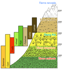
Classic version, Amazonic side
- Sea level, estimated 22 - 24°C (75°F, but the cold Humboldt Current generates fog on the coast side);
- Tierra caliente (Hot land, tropical) up to 2,500 ft (about 750 m - 1,000 m).
- Tierra templada (Temperate land, subtropical) up to 6,000 ft (about 1,850 m – 2,000 m)
(the warmest month has an average temperature of below 22°C or 72°F).
- Crops: Coffee, Tobacco, Maize, Coca, Peruvian Pepper (Schinus molle), Avocado, Guave (Psidium guajava), Cherimoya, Plum, Citrus fruits.
- Tierra fría (Cool land, temperate) below 12,000 ft (about 3,600 m, treeline)
(the warmest month has an average temperature of below 18°C or 64°F).
- Tierra helada (Cold land) above 12,000 ft (about 3,600 m)
(the definition of treeline of Coniferae: the warmest month has an average temperature of below 10°C or 50°F ).
Terrestrial Biome Type 10: Montane grasslands and shrublands
- Tierra Nevada (Janca), above the snow line, 15,000 ft (about 4,500 m - 5,000 m)
(just warmer than -1°C over rocks or just warmer than -3°C over snow, annual mean temperature).[3][4][5][6] [7]
Javier Pulgar Vidal's version
The Peruvian geographer Javier Pulgar Vidal divided Peru in 8 regions (traditionally, it was costa, sierra and selva):
Map from República del Perú - Instituto Geográfico Nacional
- Chala (West, Pacific Coast) 0– 500 m
- Omagua (Lowland jungle or Selva baja, Amazonic rainforest) 80– 400 m
- Rupa-Rupa (Highland jungle, Selva alta) 400– 1,000 m
- Yunga (Aymaran for "Warm Lands", Cloud forest)
- Loma-Vegetation (West, "Yunga costal" at the north of Peru) 450– 600 m
- Fluvial Yungas (East, "Yunga fluvial") 1,000- 2,300 m
- Quechua (East, High valleys) 2,300– 3,500 m
- Suni (or Jalca or Sallqa too, high plateaus and cliffs) 3,500– 4,100 m
- Puna (means "mountain top") 4,100– 4,800 m
- Janca (means white) above 4,800 m, permafrost, rocks, snow and ice [1]
Notes
- Biomes & Ecoregions nearby:[8]
Tropical and subtropical moist broadleaf forests
- Bolivian Yungas [9]
- Peruvian Yungas [10]
- Southwest Amazon moist forests [11]
Montane grasslands and shrublands
- Central Andean dry puna [12]
- Central Andean puna [13]
- Central Andean wet puna [14]
Overview - Amazonic side
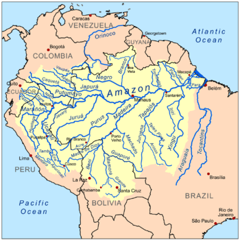
- Mouth of the Amazon River, Atlantic Ocean
- Colombia - Peru - Brazil border
- Leticia, Colombia, 84 m, annual mean temperature 25.8°C
- Tierra Caliente or Tropical rainforest
- Yunga fluvial (more than 5°C colder than the Peruan Tropics)
- Peruvian Yungas (NT0153) [10]
- Quechua (High valleys, more than 10°C colder than the Peruan Tropics)
- Treeline
- Tierra Helada
- Suni (plateau)
- Tierra Helada
- Mountain pass
- Snow line
- Tierra Nevada or Janca
- Peak
Estimated temperatures - Continental Divide
Explanations:
- Region, altitude (m); avg annual precipitation (mm); avg annual temperature (°C);
- Peruvian Highland Rainforest (Tropical climate), Cloud forest (Subtropical climate) and Temperate forest (Temperate climate);
- Cusco reference, estimated avg annual temperature (°C, Lowland Rainforest or Selva baja gets more rain, so it is more cloudy, so it is cooler);
- Snow line reference, Humboldt cold current/ Pacific climate influence, estimated avg annual temperature (°C).[22]
| Altitude | West - Pacific side | East - Amazonian side | |
|---|---|---|---|
| Highland Rainforest or Selva alta | 400 m | - | 26.5 °C |
| Loma-Vegetation | 500 m | about 21.1 °C | - |
| Cloud forest or Fluvial Yunga | 1,000 m | - | 23.5 °C |
| Quechua - Montane Valleys | 2,300 m | - | 17.2 °C |
| Amazonian Tree line of Coniferae: 10 °C | about 3,500 m | - | about 10 °C |
| Mountain pass influence | 4,100 m | about 3.4 °C | (about 7.1 °C) |
| Vegetation end | about 4,800 m | about 0.0 °C | - |
| Snow line | about 5,000 m | about -1.0 °C | - |
Example: Kallawaya Region, Bolivia
Altitudinal zonation: Kallawaya Region, around Charazani, Bolivia (border to Peru).
- Glacier
- Altitude: 5,900- 5,200 m, Annual mean temperature: below 0 °C, Agriculture: none
- High Mountain Desert, Werneria ciliolata on scree
- Altitude: 5,200- 5,000 m, Annual mean temperature: below 0 °C - 0 °C, Agriculture: none.
- Grass Zone
- Calamagrostis minima Steppe,
- Altitude: 5,000- 4,600 m, Annual mean temperature: 0- 3.5 °C, Farming: alpacas, lamas.
- Pycnophyllum Steppe,
- Altitude: 4,600- 4,300 m, Annual mean temperature: 3.5- 7.5 °C, Farming: alpacas, lamas.
- Aciachne Humid Grassland,
- Calamagrostis minima Steppe,
- Shrub Zone
- Satureja Shrub (westslope), Baccharis pentandii Shrub, with Berberis (eastslope),
- Mutisia Shrub (westslope), Baccharis pentlandii Shrub, with Siphocampylus (eastslope),
- Kaunia longipetiolata Shrub,
- Altitude: 3,200- 2,700 m, Annual mean temperature: 13.5- 16.5 °C, Farming: cattle; Agriculture: maize, wheat, beans, spring potatoes, use of fertilizers, no crop rotation.
- Highland Rainforest,
Gallery
-
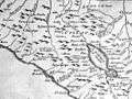
Watershed around Lake Titicaca, Arequipa, Puno and Cusco
-

Costa - Sierra - Selva
-
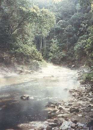
Rupa-Rupa - High Rain forest
-
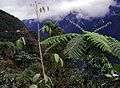
Mist forest (2,500 m)
-
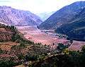
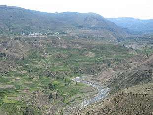
Sacred Valley of the Incas between Písac and Ollantaytambo (2002)
-
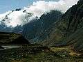
Mountain slope (4,000 m)
-
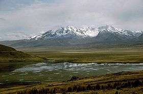
Lake Quñuqqucha (4,050 m)
-
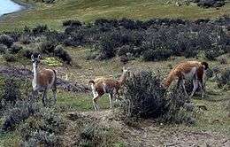
Puna with shrubs
-

Region of Ayacucho, Peru, 1986 - Puna
-
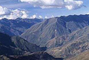
Region of Ayacucho, Peru, 1986 - Puna
-
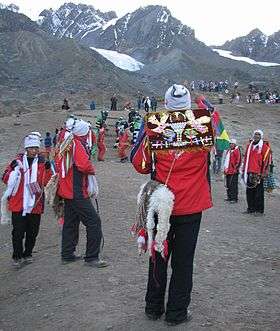
Quyllur Rit'i, glacier and alpine desert - 2007
-
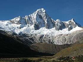
Huáscarán National Park; Cordillera Blanca; Tawllirahu (5,830 m); North of Lima
See also
- Climate of Peru
- Ecoregions of Peru
- Geography of Peru
- Altitudinal zonation
References
- 1 2 Pulgar Vidal, Javier: Geografía del Perú; Las Ocho Regiones Naturales del Perú. Edit. Universo S.A., Lima 1979. First Edition (his dissertation of 1940): Las ocho regiones naturales del Perú, Boletín del Museo de Historia Natural „Javier Prado“, n° especial, Lima, 1941, 17, pp. 145-161.
- ↑ Benavides Estrada, Juan (1999); Geografía del Perú 2do año de Secuandaria. Lima: Escuela Nueva.
- ↑ Brigitta Schütt (2005); Azonale Böden und Hochgebirgsböden
- ↑ Zech, W. and Hintermaier-Erhard, G. (2002); Böden der Welt – Ein Bildatlas, Heidelberg, p. 98.
- ↑ Christopher Salter, Joseph Hobbs, Jesse Wheeler and J. Trenton Kostbade (2005); Essentials of World Regional Geography 2nd Edition. NY: Harcourt Brace. p.464-465.
- ↑ Middle America: Altitudinal Zonation
- ↑ http://www.andix.com/huaraz_maps/huaraz.html Maps of the Cordillera Blanca - Peru
- ↑ WWF Global 200: World Map of 14 Terrestrial Biomes and 867 Ecoregions
- ↑ "Bolivian Yungas". Terrestrial Ecoregions. World Wildlife Fund.
- 1 2 "Peruvian Yungas". Terrestrial Ecoregions. World Wildlife Fund.
- 1 2 "Southwest Amazon moist forests". Terrestrial Ecoregions. World Wildlife Fund.
- ↑ "Central Andean dry puna". Terrestrial Ecoregions. World Wildlife Fund.
- 1 2 "Central Andean puna". Terrestrial Ecoregions. World Wildlife Fund.
- ↑ "Central Andean wet puna". Terrestrial Ecoregions. World Wildlife Fund.
- ↑ "Atacama desert". Terrestrial Ecoregions. World Wildlife Fund.
- ↑ "Sechura desert". Terrestrial Ecoregions. World Wildlife Fund.
- ↑ "Gurupa varzea". Terrestrial Ecoregions. World Wildlife Fund.
- ↑ "Monte Alegre varzea". Terrestrial Ecoregions. World Wildlife Fund.
- ↑ "Purus varzea". Terrestrial Ecoregions. World Wildlife Fund.
- ↑ "Iquitos varzea". Terrestrial Ecoregions. World Wildlife Fund.
- ↑ "Central Andean wet puna". Terrestrial Ecoregions. World Wildlife Fund.
- ↑ Klimadiagramme weltweit - Europa
- ↑ Seibert, Paul; Farbatlas Südamerika, Verlag Eugen Ulmer, 1996.
.svg.png)
