List of lighthouses in Delaware

This is a list of all lighthouses in the U.S. state of Delaware as identified by the United States Coast Guard. The first lighthouse in the state was erected in 1769[1] and the last in 1925 (ignoring automated towers erected later); the oldest active light is the Fenwick Island Light.[2]

If not otherwise noted, focal height and coordinates are taken from the United States Coast Guard Light List,[3] while location and dates of activation, automation, and deactivation are taken from the United States Coast Guard Historical information site for lighthouses.[2]
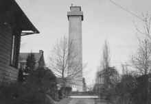
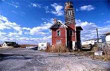
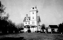
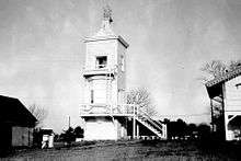
Name Location Coordinates Image Focal
Height
Built[note 1] Automated Deactivated Status
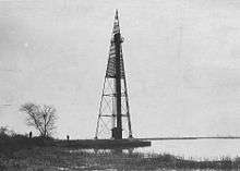
Baker Shoal Range Front Light Port Penn 39°32′27″N 75°34′00″W / 39.5409°N 75.5666°W / 39.5409; -75.5666 (Baker Shoal Range Front Light) 1904 1924 Replaced with skeleton tower
Baker Shoal Range Rear Light Port Penn 39°30′43″N 75°34′12″W / 39.5120°N 75.5699°W / 39.5120; -75.5699 (Baker Shoal Range Rear Light) 110 ft (34 m) 1904 1924[4] Active
Bellevue Range Rear Light Wilmington 39°43′13″N 75°31′04″W / 39.7203°N 75.5179°W / 39.7203; -75.5179 (Bellevue Range Rear Light)[5] 100 ft (30 m)[6] 1909 1934[5] 2001 Inactive
Cape Henlopen Beacon Lewes 38°47′25″N 75°04′50″W / 38.7903°N 75.0806°W / 38.7903; -75.0806 (Cape Henlopen Beacon)[7] 45 ft (14 m)[7] 1825/1864[8] 1884[8] demolished[8]
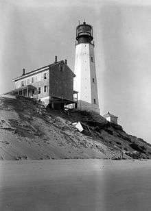
Cape Henlopen Light Lewes 38°46′41″N 75°05′02″W / 38.778°N 75.084°W / 38.778; -75.084 (Cape Henlopen Light)[9] 126 ft (38 m)[9] 1769 1924 Destroyed by storm in 1926
Cherry Island Range Rear Light near Edgemoor 39°45′43″N 75°29′24″W / 39.762°N 75.490°W / 39.762; -75.490 (Cherry Island Range Rear Light)[10] 120 ft (37 m)[10] 1880 unknown replaced with skeleton tower;
torn down ca. 1970
Christiana Light north bank of the Christina River 39°43′19″N 75°31′12″W / 39.722°N 75.520°W / 39.722; -75.520 (Christiana Light)[11] 44 ft (13 m)[11] 1835[12] 1909[12] demolished in 1935[12]
Christiana North Jetty Light mouth of the Christina River 39°43′05″N 75°30′58″W / 39.718°N 75.516°W / 39.718; -75.516 (Christiana North Jetty Light)[11] 37 ft (11 m)[11] 1884[5] unknown[note 2] demolished
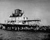
Delaware Breakwater East End Light Lewes 38°47′50″N 75°06′01″W / 38.7972°N 75.1003°W / 38.7972; -75.1003 (Delaware Breakwater East End Light) 60 ft (18 m) 1885 1950 1996 inactive
Delaware Breakwater Range Front Light Lewes 38°47′57″N 75°06′29″W / 38.7992°N 75.1081°W / 38.7992; -75.1081 (Delaware Breakwater Range Front Light)[13] 45 ft (14 m)[13] 1838/1849 1903 demolished in 1950
Delaware Breakwater Range Rear Light Lewes 38°47′23″N 75°10′10″W / 38.7897°N 75.1694°W / 38.7897; -75.1694 (Delaware Breakwater Range Rear Light)[11] 103 ft (31 m)[11] 1881[14] 1918[14] dismantled and re-erected as Gasparilla Island Light[14]
Fenwick Island Light Fenwick Island 38°27′05″N 75°03′18″W / 38.4514°N 75.0550°W / 38.4514; -75.0550 (Fenwick Island Light)[15] 83 ft (25 m) 1859 1940 1978–1982 Active; private aid
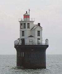
Fourteen Foot Bank Light Delaware Bay off Bowers Beach 39°02′54″N 75°10′56″W / 39.0482°N 75.1822°W / 39.0482; -75.1822 (Fourteen Foot Bank Light) 59 ft (18 m) 1887 1972 Active
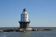
Harbor of Refuge Light Lewes 38°48′52″N 75°05′33″W / 38.8145°N 75.0924°W / 38.8145; -75.0924 (Harbor of Refuge Light) 72 ft (22 m) 1908/1925 1973 Active
Liston Range Front Light Bay View Beach 39°28′57″N 75°35′30″W / 39.4825°N 75.5917°W / 39.4825; -75.5917 (Liston Range Front Light)[note 3] 45 ft (14 m) 1906 1976 Inactive; light moved to adjacent skeleton tower
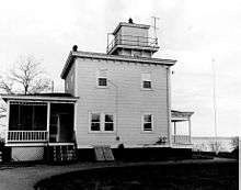
Liston Range Rear Light E of Biddles Corner 39°31′26″N 75°38′23″W / 39.5238°N 75.6397°W / 39.5238; -75.6397 (Liston Range Rear Light) 176 ft (54 m) 1906 1936[16] Active
Mahon River Light Port Mahon 39°11′06″N 75°24′03″W / 39.1850°N 75.4008°W / 39.1850; -75.4008 (Mahon River Light) 37 ft (11 m) 1831/1903 1955 replaced with skeleton tower; burned down in 1984
Marcus Hook Range Front Light near Bellefonte 39°46′34″N 75°28′31″W / 39.7760°N 75.4754°W / 39.7760; -75.4754 (Marcus Hook Range Front Light) 81 ft (25 m) 1925 active
Marcus Hook Range Rear Light Bellefonte 39°45′44″N 75°30′12″W / 39.7622°N 75.5032°W / 39.7622; -75.5032 (Marcus Hook Range Rear Light) 278 ft (85 m) 1915/1920 1950s active
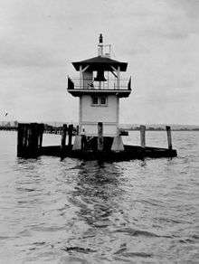
Mispillion Light on the Mispillion River 38°56′51″N 75°18′56″W / 38.9475°N 75.3156°W / 38.9475; -75.3156 (Mispillion Light) 46 ft (14 m)[11] 1831/1873 1926 1929 replaced with skeleton tower; burned in 2002
New Castle Range Rear Light near New Castle 39°38′54″N 75°35′56″W / 39.6482°N 75.5990°W / 39.6482; -75.5990 (New Castle Range Rear Light) 100 ft (30 m) 1876 1953 replaced by skeleton tower; original house burned in 1982
New Castle Range Front Light near New Castle 39°38′33″N 75°35′43″W / 39.6424°N 75.5954°W / 39.6424; -75.5954 (New Castle Range Front Light) 56 ft (17 m)[note 4] 1876 1963 replaced by skeleton tower
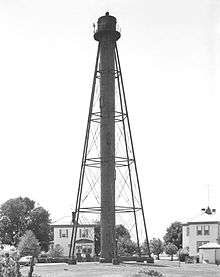
Reedy Island Range Rear Light near Taylors Bridge 39°24′23″N 75°35′25″W / 39.4065°N 75.5902°W / 39.4065; -75.5902 (Reedy Island Range Rear Light) 134 ft (41 m) 1910[17] unknown active

Notes

  1. ↑ If there is a second date, it represents the date the most recent tower was lit.
  2. ↑ Charts show the light up to 1930 but the light appears in listings to the end of the decade.
  3. ↑ current tower
  4. ↑ current tower

References

  1. ↑ "Lighthouses of the United States: Delaware". Russ Rowlett.
  2. 1 2 "Historic Light Station Information and Photography: Delaware". United States Coast Guard Historian's Office.
  3. ↑ Light List, Volume II, Atlantic Coast, Shrewsbury River, New Jersey to Little River, South Carolina (PDF). Light List. United States Coast Guard. 2012.
  4. ↑ "Baker Rear Range, DE". LighthouseFriends.
  5. 1 2 3 "Bellevue Rear Range, DE". LighthouseFriends.
  6. ↑ "Inventory of Historic Light Stations: Bellevue Range Rear Light". National Park Service.
  7. 1 2 List of Light-houses, Lighted Beacons, and Floating Lights of the Atlantic, Gulf, and Pacific Coasts of the United States. Treasury Department. January 1, 1868. pp. 24–25. Retrieved 2014-01-23.
  8. 1 2 3 "Delaware Breakwater Light". LighthouseFriends. Retrieved 2014-01-23.
  9. 1 2 List of Lights and Fog Signals on the Atlantic and Gulf Coasts of the United States. Washington, DC: Government Printing Office. June 30, 1900. p. 106.
  10. 1 2 "Cherry Island Range, DE". LighthouseFriends.
  11. 1 2 3 4 5 6 7 List of Lights and Fog Signals on the Atlantic and Gulf Coasts of the United States. Government Printing Office. March 1, 1907. p. 124. Retrieved 2014-01-15.
  12. 1 2 3 Trapani, Bob (2007). "Christiana River Light Station". Delaware Lights: A History of Lighthouses in the First State. History Press. pp. 46–49. Retrieved 2014-01-21.
  13. 1 2 List of Lights and Fog Signals on the Atlantic and Gulf Coasts of the United States. Government Printing Office. June 30, 1900. p. 94. Retrieved 2014-01-23.
  14. 1 2 3 "Delaware Breakwater Rear Range (Green Hill) Light". LighthouseFriends. Retrieved 2014-01-23.
  15. ↑ "Fenwick Island, DE". LighthouseFriends.
  16. ↑ "Liston rear Range, DE". Lighthouse Friends.
  17. ↑ "Inventory of Historic Light Stations: Delaware Lighthouses: Reedy Island Range Rear Light". National Park Service. Retrieved 2013-12-20.
This article is issued from Wikipedia - version of the 10/18/2016. The text is available under the Creative Commons Attribution/Share Alike but additional terms may apply for the media files.